Sandy Springs in Fulton County, Georgia — The American South (South Atlantic)
The History of the City of Sandy Springs, Georgia
Inscription.
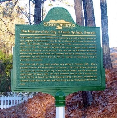
Sandy Springs, Georgia, the unincorporated community just north of Atlanta, began a 30-year campaign for incorporation when the City of Atlanta tried to annex the area in the 1970s. The Committee for Sandy Springs formed in 1975 to incorporate Sandy Springs into its own city. The Committee introduced bills into the Georgia General Assembly calling for a referendum on incorporation. Year after year, the bill died in the Georgia House of Representatives. In 2000, the Committee filed suit in federal court. In 2005, the referendum was held, and on June 21, 2005, the residents of Sandy Springs voted 94 percent for incorporation.
The mayor and six council members were elected in November 2005. With a population of more than 85,000 citizens, on December 1, 2005, Sandy Springs incorporated and became the seventh largest city in the State of Georgia. The city encompassed approximately 39 square miles. The city’s boundaries were the City of Atlanta to the south, the City of Roswell and the Chattahoochee River to the north, the DeKalb and Gwinnett County lines to the east, and Cobb County and the Chattahoochee River to the west.
Reverse
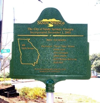
The City of Sandy Springs, Georgia Incorporated December 1, 2005
Mayor: Eva Galambos
City Council: Tiberio “Tibby” DeJulio
Dianne Fries
Dave Greenspan
Ashley Jenkins
Karen Meinzen McEnerny
Rusty Paul
Presented by Leadership Sandy Springs, Class of 2006
Sponsored by Cox Enterprises, Inc.
Erected 2006 by Leadership Sandy Springs, Class of 2006.
Topics. This historical marker is listed in this topic list: Political Subdivisions. A significant historical month for this entry is June 1847.
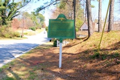
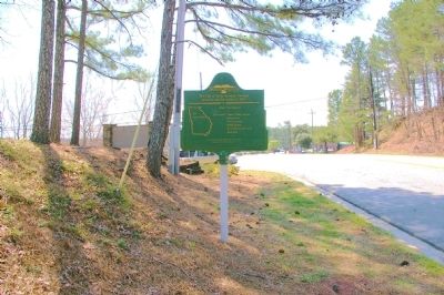
Location. 33° 55.293′ N, 84° 23.026′ W. Marker is in Sandy Springs, Georgia, in Fulton County. Marker is at the intersection of Sandy Springs Circle and Sandy Springs Place, on the right when traveling north on Sandy Springs Circle. The marker stands just south of the Williams-Payne House, location of the original Sandy Springs. Touch for map. Marker is in this post office area: Atlanta GA 30328, United States of America. Touch for directions.
Other nearby markers. At least 8 other markers are within 2 miles of this marker, measured as the crow flies. The Sandy Springs (about 400 feet away, measured in a direct line); Sandy Springs United Methodist Church Historic Cemetery (about 700 feet away); Gen. J. D. Cox's Div. To Old Cross Keys (approx. half a mile away); 23d A.C. to Decatur (approx. 0.6 miles away); To Sandy Springs and Old Cross Keys (approx. 0.8 miles away); Hascall's Div. Joins Cox's Line of March (approx. 1.8 miles away); Garrard & Newton Move on Roswell (approx. 2 miles away); Hascall’s Div. Camped (approx. 2.1 miles away). Touch for a list and map of all markers in Sandy Springs.
Also see . . . Sandy Springs, Georgia. Wikipedia contains a much more detailed history of the creation of Sandy Springs, mentioning the fact that all city services other than public safety were privatized as part of the design of the city government. This "Sandy Springs Model" has been used by a number of other new cities (including at least one in Japan). (Submitted on March 13, 2012, by David Seibert of Sandy Springs, Georgia.)
Credits. This page was last revised on August 21, 2020. It was originally submitted on March 12, 2012, by David Seibert of Sandy Springs, Georgia. This page has been viewed 1,022 times since then and 35 times this year. Photos: 1, 2, 3, 4. submitted on March 12, 2012, by David Seibert of Sandy Springs, Georgia. • Craig Swain was the editor who published this page.


