Near Powhatan in Powhatan County, Virginia — The American South (Mid-Atlantic)
Mohemenco (A Monacan Village) and Drake House
Inscription.
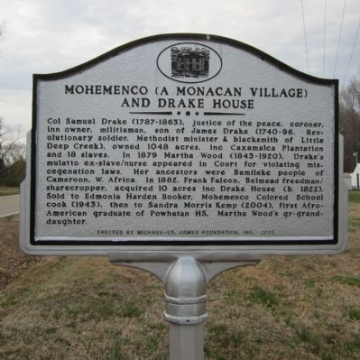
Col Samuel Drake (1787-1863), justice of the peace, coroner, inn owner, militiaman, son of James Drake (1740-96, Revolutionary soldier, Methodist minister & blacksmith of Little Deep Creek), owned 1048 acres, inc Caxamalca Plantation and 18 slaves. In 1879 Martha Wood (1843-1920), Drake's mulatto ex-slave/nurse appeared in Court for violating miscegenation laws. Her ancestors were Bamileke people of Cameroon, W. Africa. In 1882, Frank Falcon, Belmead freedman/sharecropper, acquired 10 acres inc Drake House (b. 1822). Sold to Edmonia Harden Booker, Mohemenco Colored School cook (1943), then to Sandra Morris Kemp (2004), first Afro-American graduate of Powhatan HS, Martha Wood's gr-grandaughter.
Erected 2007 by Michaux-St. James Foundation.
Topics. This historical marker is listed in these topic lists: African Americans • Education • Native Americans.
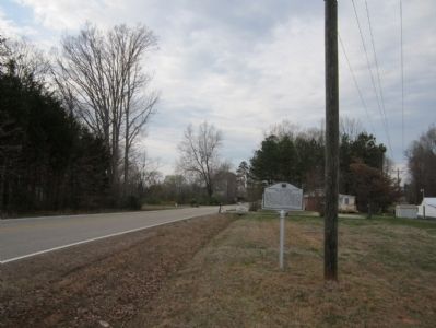
Location. 37° 35.688′ N, 77° 58.698′ W. Marker is near Powhatan, Virginia, in Powhatan County. Marker is on Bell Road (Virginia Route 684) half a mile north of Powhatan Lakes Road (Virginia Route 625), on the right when traveling north. Touch for map. Marker is in this post office area: Powhatan VA 23139, United States of America. Touch for directions.
Other nearby markers. At least 8 other markers are within 5 miles of this marker, measured as the crow flies. Dunlora Academy (approx. 2.7 miles away); Pocahontas High School (approx. 3 miles away); Giles's Home (approx. 3.4 miles away); Mosby’s Tavern / Cumberland Old Courthouse (approx. 3.8 miles away); Muddy Creek School (approx. 4.7 miles away); The Courthouse Tavern / Atkinson's Hotel / The Village (approx. 4.9 miles away); The Powhatan Troop (approx. 4.9 miles away); Memorial to Powhatan Servicemen (approx. 4.9 miles away). Touch for a list and map of all markers in Powhatan.
Also see . . . Michaux-St. James Foundation. (Submitted on March 15, 2012.)
Credits. This page was last revised on November 11, 2021. It was originally submitted on March 15, 2012, by Bernard Fisher of Richmond, Virginia. This page has been viewed 1,296 times since then and 39 times this year. Photos: 1, 2. submitted on March 15, 2012, by Bernard Fisher of Richmond, Virginia.

