Memphis in Shelby County, Tennessee — The American South (East South Central)
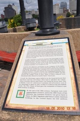
France
In 1673, Louis Jolliet, a French trader, and Father Jacques Marquette, a Jesuit missionary, became the second Europeans to discover the Mississippi. Their expedition paddled birchbark canoes downstream from the mouth of the Illinois River, stopping briefly at the Chickasaw Bluffs, reached a point near the mouth of either the Arkansas or the St. Francis River. There, Native Americans told them that Spain held the southern part of the river, though 131 years had passed since DeSoto's army had fled. Wary of a confrontation, the Frenchmen returned to Canada.
La Salle's expedition reached the mouth of the Mississippi in 1681. Finding no Spanish, La Salle claimed the river and its valley for France, naming the entire territory Louisiana, in honor of King Louis XIV. Fort de la Boulaye, 40 miles north of the mouth, became the first European settlement on the river in 1700. New Orleans, the capital of French Louisiana, was founded in 1718.
Lured by the aggressive promotion of the Company of the Indies, many European immigrants settled along parts of the river. Sections of Missouri, and modern-day Louisiana were settled during France's reign on the Mississippi, but most of the lower river remained Native American territory. A number of forts were established along the river, including Fort Assumption on the Fourth Chickasaw Bluff, near the present day bridges south of here. Many of these outposts were abandoned after attacks by hostile Native Americans.
Overall, the Mississippi region failed to be the financial boom that had been expected, and France often had to subsidize the colony. When it became obvious that France was losing the Seven Years' War to Britain, Louis XV ceded lower Louisiana and all territory west of the Mississippi to Spain in 1762, so that it would not fall into British hands. The 1763, Treaty of Paris gave the remainder of France's east bank territory to Britain.
By the end of the 18th century, European wars were sapping Spain's resources, and in the 1800 Treaty of San Ildefonso, the Louisiana Territory was given back to France. In 1803, Napoleon sold France's entire American holdings to the United States for $15 million.
Erected by Mud Island River Park.
Topics. This historical marker is listed in these topic lists: Exploration • Native Americans • Settlements & Settlers. A significant historical year for this entry is 1673.
Location. 35° 8.656′ N, 90° 3.559′ W. Marker is in Memphis, Tennessee, in Shelby County. Marker can be reached from Island Drive, one mile south of A.W. Willis Avenue. Marker is at the south end of Mud Island under the French flag. Touch for map. Marker is at or near this postal address: 125 North Front Street, Memphis TN 38103, United States of America. Touch for directions.
Other nearby markers. At least 8 other markers are within walking distance of this marker. Great Britain (here, next to this marker); North Carolina (here, next to this marker); Tennessee (here, next to this marker); Confederate States of America (a few steps from this marker); Spain (a few steps from this marker); Memphis Queen II (approx. 0.2 miles away); Cobblestones (approx. 0.2 miles away); Civil War Hospital (approx. ¼ mile away). Touch for a list and map of all markers in Memphis.
Also see . . . Fort Assumption Built. Online Edition of Ramsey's Annals of Tennessee (Submitted on March 20, 2012.)
Credits. This page was last revised on November 5, 2020. It was originally submitted on March 20, 2012, by Sandra Hughes Tidwell of Killen, Alabama, USA. This page has been viewed 626 times since then and 27 times this year. Photos: 1, 2, 3. submitted on March 20, 2012, by Sandra Hughes Tidwell of Killen, Alabama, USA. • Bernard Fisher was the editor who published this page.


