Fredericksburg, Virginia — The American South (Mid-Atlantic)
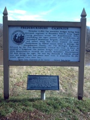
Fredericksburg Campaign
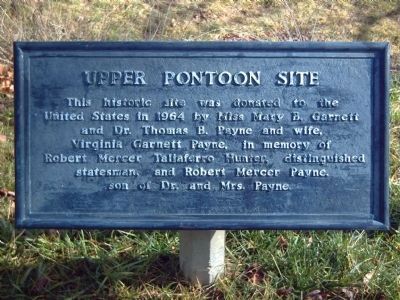
Below the marker is another marker commemorating the donation of the land. It reads:
This historic site was donated to the United States in 1964 by Miss Mary B. Garnett and Dr. Thomas B. Payne and wife, Virginia Garnett Payne, in memory of Robert Mercer Taliaferro Hunter, distinguished statesman, and Robert Mercer Payne, son of Dr. and Mrs. Payne.
Erected by United States Department of the Interior, National Park Service.
Topics. This historical marker is listed in these topic lists: War, US Civil • Waterways & Vessels. A significant historical date for this entry is December 11, 1764.
Location. 38° 18.461′ N, 77° 27.649′ W. Marker is in Fredericksburg, Virginia. Marker is on Sophia Street near Hawke Street, on the right when traveling north. Touch for map. Marker is in this post office area: Fredericksburg VA 22401, United States of America. Touch for directions.
Other nearby markers. At least 8 other markers are within walking distance of this marker. Pontoon Bridge Site (here, next to this marker); 7th Michigan Volunteer Infantry (here, next to this marker); 1856 (about 300 feet away, measured in a direct line); 1883 (about 300 feet away); 1868 (about 400 feet away); Rising Sun Tavern (about 400 feet away); a different marker also named Rising Sun Tavern (about 400 feet away); Fire on Caroline Street (about 600 feet away). Touch for a list and map of all markers in Fredericksburg.
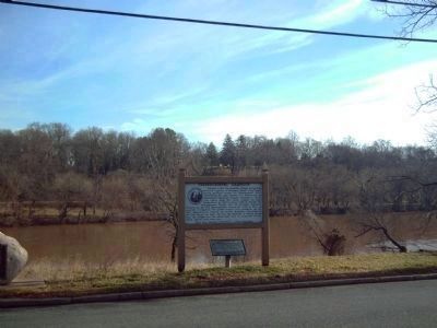
Related markers. Click here for a list of markers that are related to this marker. Between the uprights of this marker can be seen two other markers across the Rappahannock River. This is link will display the links for those two markers.
Also see . . .
1. Entry for R.M.T. Hunter from the Biographical Directory of the United States Congress. During the Civil War, Robert Mercer Taliaferro Hunter served in the Confederate Senate from Virginia in the First and Second Congresses 1862-1865 and was President pro tempore on various occasions. (Submitted on February 14, 2008, by Kevin W. of Stafford, Virginia.)
2. Robert M. Payne Scholarship Fund at the University of Virginia School of Medicine. Established by the medical school Class of 1960 as a memorial to Robert Mercer Payne, a classmate who was killed in an accident prior to graduation. (Submitted on February 14, 2008, by Kevin W. of Stafford, Virginia.)
Credits. This page was last revised on February 2, 2023. It was originally submitted on February 14, 2008, by Kevin W. of Stafford, Virginia. This page has been viewed 1,661 times since then and 26 times this year. Photos: 1, 2, 3. submitted on February 14, 2008, by Kevin W. of Stafford, Virginia.


