South Berkeley in Alameda County, California — The American West (Pacific Coastal)
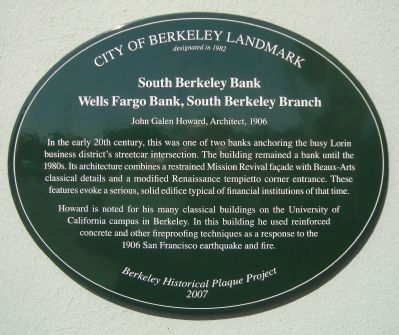
South Berkeley Bank
Wells Fargo Bank, South Berkeley Branch
— John Galen Howard, Architect, 1906 —
designated in 1982
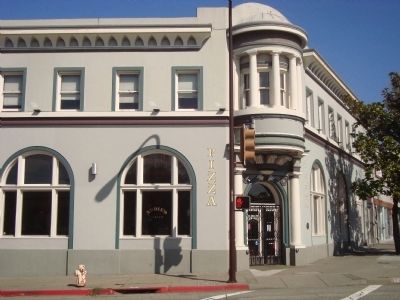
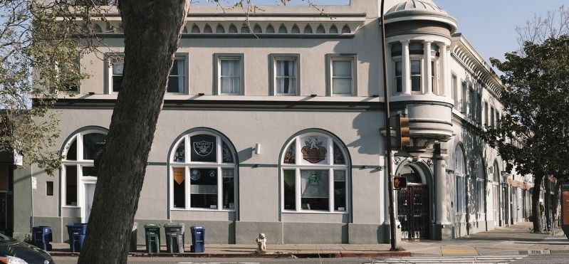
In the early 20th century, this was one of two banks anchoring the busy Lorin business district’s streetcar intersection. The building remained a bank until the 1980s. Its architecture combines a restrained Mission Revival façade with Beaux-Arts classical details and a modified Renaissance tempietto corner entrance. These features evoke a serious, solid edifice typical of financial institutions of that time.
Howard is noted for his many classical buildings on the University of California campus in Berkeley. In this building he used reinforced concrete and other fireproofing techniques as a response to the 1906 San Francisco earthquake and fire.
Erected 2007 by Berkeley Historical Plaque Project.
Topics. This historical marker is listed in these topic lists: Industry & Commerce • Notable Buildings. A significant historical year for this entry is 1982.
Location. 37° 50.932′ N, 122° 16.291′ W. Marker is in Berkeley, California, in Alameda County. It is in South Berkeley. Marker is at the intersection of Adeline Street and Alcatraz Avenue, on the right when traveling south on Adeline Street. Touch for map. Marker is at or near this postal address: 3286 Adeline Street, Berkeley CA 94703, United States of America. Touch for directions.
Other nearby markers. At least 8 other markers are within walking distance of this marker. Historic "Lorin District" (within shouting distance of this marker); Lorin Theater (about 300 feet away, measured in a direct line); Site of Reid's Records (approx. 0.4 miles away); Exxon Super Service Station (approx. half a mile away); William Byron Rumford (February 2, 1908 - June 12, 1986) (approx. half a mile away); Burl Toler, Sr. (approx. half a mile away); Rumford's Pharmacy (approx. 0.6 miles away); Santa Fe Railroad Tracks (approx. 0.6 miles away). Touch for a list and map of all markers in Berkeley.
Credits. This page was last revised on April 23, 2023. It was originally submitted on March 23, 2012, by Barry Swackhamer of Brentwood, California. This page has been viewed 716 times since then and 20 times this year. Photos: 1, 2. submitted on March 23, 2012, by Barry Swackhamer of Brentwood, California. 3. submitted on April 23, 2023, by Ed Aust of Oakland, California. • Syd Whittle was the editor who published this page.


