Northwest Berkeley in Alameda County, California — The American West (Pacific Coastal)
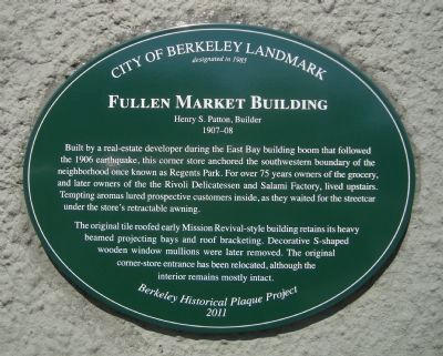
Fullen Market Building
Henry S. Patton, Builder
— 1907-08 —
designated in 1985
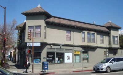
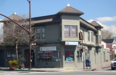
Built by a real-estate developer during the East Bay building boom that followed the 1906 earthquake, this corner store anchored the southwestern boundary of the neighborhood once known as Regents Park. For over 75 years owners of the grocery, and later owners of the the Rivoli Delicatessen and Salami Factory, lived upstairs. Tempting aromas lured prospective customers inside, as the waited for the streetcar under the store’s retractable awning.
The original tile roofed early Mission Revival-style building retains its heavy beamed projecting bays and roof bracketing. Decorative S-shaped wooden window mullions were later removed. The original corner-store entrance has been relocated, although the interior remains mostly intact.
Erected 2011 by Berkeley Historical Plaque Project.
Topics. This historical marker is listed in these topic lists: Architecture • Industry & Commerce. A significant historical year for this entry is 1985.
Location. 37° 52.53′ N, 122° 17.634′ W. Marker is in Berkeley, California, in Alameda County. It is in Northwest Berkeley. Marker is at the intersection of Hopkins Avenue and San Pablo Avenue on Hopkins Avenue. This is a three-way intersection - San Pablo Avenue, Cedar Street and Hopkins Avenue. Touch for map. Marker is at or near this postal address: 1531 San Pablo Avenue, Berkeley CA 94702, United States of America. Touch for directions.
Other nearby markers. At least 8 other markers are within walking distance of this marker. Toveri Tupa – Finnish Hall (approx. 0.3 miles away); Church of the Good Shepherd (approx. 0.4 miles away); 935 Hearst Avenue (approx. 0.4 miles away); Bowen’s Inn/Higgins Grocery (approx. 0.4 miles away); Delaware Street Historic District (approx. half a mile away); Workingman’s Hall (approx. 0.6 miles away); Santa Fe Railway Depot (approx. 0.6 miles away); Spenger’s Fish Grotto (approx. 0.6 miles away). Touch for a list and map of all markers in Berkeley.
Credits. This page was last revised on February 7, 2023. It was originally submitted on March 23, 2012, by Barry Swackhamer of Brentwood, California. This page has been viewed 598 times since then and 14 times this year. Photos: 1, 2, 3. submitted on March 23, 2012, by Barry Swackhamer of Brentwood, California. • Syd Whittle was the editor who published this page.


