Oceanside in San Diego County, California — The American West (Pacific Coastal)
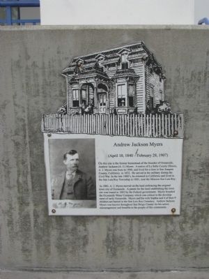
Andrew Jackson Myers
(April 10, 1840 - February 28, 1907)
In 1882, A.J. Myers moved on the land embracing the original town site of Oceanside. A patent for the land establishing the town site was issued in 1883 by the Federal government. Myers founded the Oceanside Water Company, which was critical to the development of early Oceanside. Myers and his wife Sophia and 4 of their 9 children are buried in the San Luis Rey Cemetery. Andrew Jackson Myers was known throughout San Diego County for his active encouragement, and benefits to the people of this community.
Topics. This historical marker is listed in these topic lists: Settlements & Settlers • War, US Civil. A significant historical year for this entry is 1840.
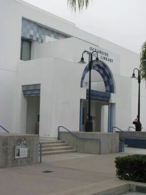
Location. 33° 11.822′ N, 117° 22.827′ W. Marker is in Oceanside, California, in San Diego County. Marker is on North Coast Highway south of Civic Center Drive, on the left when traveling south. Touch for map. Marker is at or near this postal address: 330 North Coast Highway, Oceanside CA 92054, United States of America. Touch for directions.
Other nearby markers. At least 8 other markers are within 3 miles of this marker, measured as the crow flies. September 11th Memorial (approx. 0.2 miles away); The Top Gun House (approx. ¼ mile away); Oceanside Pier (approx. ¼ mile away); Remember Pearl Harbor (approx. 1.1 miles away); Alligator Marines (approx. 1.8 miles away); Boys of '45 (approx. 2 miles away); Retreat Hell! (approx. 2 miles away); The Twin Inns Granary (approx. 2.9 miles away). Touch for a list and map of all markers in Oceanside.
Credits. This page was last revised on November 7, 2019. It was originally submitted on April 8, 2012, by Denise Boose of Tehachapi, California. This page has been viewed 1,054 times since then and 43 times this year. Photos: 1, 2, 3, 4. submitted on April 8, 2012, by Denise Boose of Tehachapi, California. • Syd Whittle was the editor who published this page.


