Fairview Heights in Lynchburg, Virginia — The American South (Mid-Atlantic)
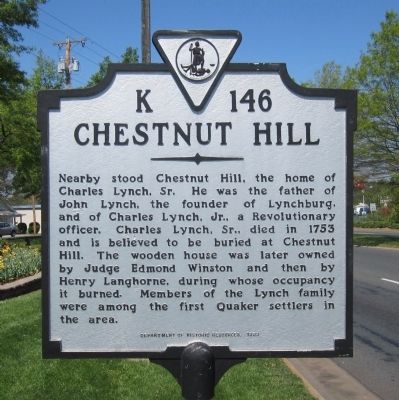
Chestnut Hill
Erected 1999 by Department of Historic Resources. (Marker Number K-146.)
Topics and series. This historical marker is listed in this topic list: Settlements & Settlers. In addition, it is included in the Quakerism, and the Virginia Department of Historic Resources (DHR) series lists. A significant historical year for this entry is 1753.
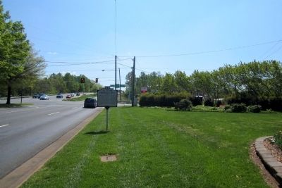
Location. 37° 22.825′ N, 79° 8.054′ W. Marker is in Lynchburg, Virginia. It is in Fairview Heights. Marker is at the intersection of Campbell Avenue (Business U.S. 501) and Martin Street, on the right when traveling south on Campbell Avenue. Touch for map. Marker is in this post office area: Lynchburg VA 24501, United States of America. Touch for directions.
Other nearby markers. At least 8 other markers are within 2 miles of this marker, measured as the crow flies. Lynchburg Defenses (approx. 0.4 miles away); Virginia Collegiate and Industrial Institute (approx. 0.9 miles away); Desmond Thomas Doss (approx. 1.1 miles away); Ota Benga (approx. 1.4 miles away); Virginia University of Lynchburg (approx. 1.4 miles away); John Chilembwe (approx. 1.4 miles away); Gregory Willis Hayes (approx. 1.4 miles away); Lynchburg Presbyterian Cemetery (approx. 1˝ miles away). Touch for a list and map of all markers in Lynchburg.
Credits. This page was last revised on February 1, 2023. It was originally submitted on April 13, 2012, by Bernard Fisher of Richmond, Virginia. This page has been viewed 1,027 times since then and 72 times this year. Photos: 1, 2. submitted on April 13, 2012, by Bernard Fisher of Richmond, Virginia.

