Near Oriskany in Oneida County, New York — The American Northeast (Mid-Atlantic)
Relief for Fort Stanwix
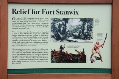
On August 3, 1777, when British General Barry St.Leger reached Fort Stanwix, he found it held by colonial forces and began a siege. Soon after, to relieve the fort, about 800 men of the Tryon County Militia, commanded by General Nicholas Herkimer, and a contingent of Oneida allies began marching westward down the Mohawk Valley, following the military road.
When St.Leger learned of their approach, he dispatched a force of about 100 Loyalist troops and roughly 400 Indians, principally Seneca and Mohawk, to intercept the relief column. Here at Oriskany, hiding in dark forests at the edge of a deep ravine along the military road, the British and allied Indians ambushed the Tryon County Militia in a bloody battle. Facing heavy losses and stubborn resistance, the British and their Native American allies abandoned the fight, leaving the militia badly mauled.
The retreating British returned to the fort to find their siege camps raided by the garrison from Fort Stanwix. The assault against the fort continued indecisively until St.Leger's Native American allies withdrew in frustration, ultimately forcing St.Leger to return to Canada and abandon the over-all effort to take the Mohawk Valley. Thus, the Battle of Oriskany assisted in derailing Burgoyne's campaign and helped lead to the decisive American victory at Saratoga later that fall.
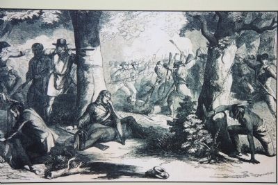
The ambush caught the militia completely by surprise. Many of the militiamen fled through the woods pursued by Mohawk warriors.
Initially disorganized and frightened, many militiamen hid behind trees, fighting for their lives in small, scattered groups
Despite efforts to move him out of harm's way, a wounded General Herkimer attempts to direct the battle from a high point north of the ravine.
Topics. This historical marker is listed in these topic lists: Colonial Era • Native Americans • War, US Revolutionary. A significant historical year for this entry is 1777.
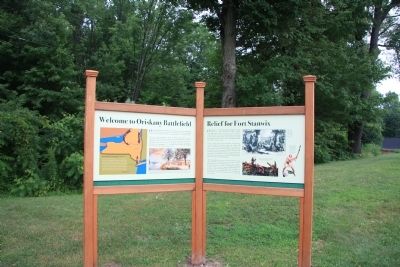
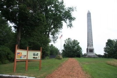
Location. 43° 10.628′ N, 75° 22.198′ W. Marker is near Oriskany, New York, in Oneida County. Marker can be reached from Rome Oriskany Road, 0.4 miles east of Monument Road. This historic marker is located at the Oriskany Battlefield State Historic Site park, at the back edge of the parking lot, along the walking path that leads to the Oriskany Battlefield Memorial Monument. Touch for map. Marker is in this post office area: Oriskany NY 13424, United States of America. Touch for directions.
Other nearby markers. At least 8 other markers are within walking distance of this marker. Welcome to Oriskany Battlefield (here, next to this marker); Site of The Battle of Oriskany (here, next to this marker); Here the Battle of Oriskany Was Fought (within shouting distance of this marker); The Rally
(within shouting distance of this marker); A Clash of Cultures (within shouting distance of this marker); Alliances Drawn (within shouting distance of this marker); In the Valley homes was great mourning (about 300 feet away, measured in a direct line); Near This Spot (about 500 feet away). Touch for a list and map of all markers in Oriskany.
Credits. This page was last revised on November 29, 2021. It was originally submitted on April 14, 2012, by Dale K. Benington of Toledo, Ohio. This page has been viewed 613 times since then and 33 times this year. Photos: 1, 2, 3, 4. submitted on April 14, 2012, by Dale K. Benington of Toledo, Ohio.


