Rice in Amelia County, Virginia — The American South (Mid-Atlantic)
Crossing Little Sailor's Creek
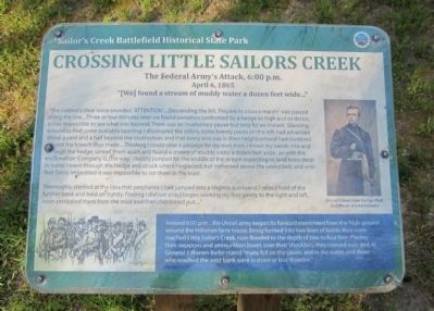
The Federal Army's Attack, 6:00 p.m. April 6, 1865
— Sailor's Creek Battlefield Historical State Park —
"We found a stream of muddy water a dozen feet wide..."
“The colonel’s clear voice sounded ‘ATTENTION’....Descending the hill; ‘Prepare to cross a marsh!’ was passed along the line....Three or four minutes later we found ourselves confronted by a hedge so high and so dense, it was impossible to see what was beyond. There was an involuntary pause-but only for an instant. Glancing around to find some available opening, I discovered the colors, some twenty paces on the left, had advanced about a yard and a half beyond the obstruction, and that every one was in their neighborhood had clustered around the breach thus made....Thinking I could clear a passage for my own men, I thrust my hands into and through the hedge, spread them apart and found a stream of muddy water a dozen feet wide…so with the exclamation ‘Company G, this way,’ I boldly jumped for the middle of the stream expecting to land knee-deep in water. I went through the hedge and struck where I expected, but immersed above the sword belt, and with feet firmly imbedded it was impossible to stir them in the least.
Thoroughly startled at the idea that perchance I had jumped into a Virginia quicksand, I seized hold of the further bank and held on tightly. Finding I did not sink, I began working my feet gently to the right and left, soon extricated them from the mud and then clambered out...."
(sidebar)
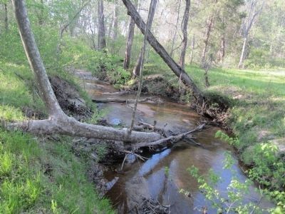
Around 6:00 pm…the Union army began its forward movement from the high ground around the Hillsman farm house. Being formed into two lines of battle, they soon reached Little Sailor’s Creek, now flooded to the depth of two to four feet. Placing their weapons and ammunition boxes over their shoulders, they crossed over and, as General J. Warren Keifer noted “many fell on the plains and in the water, and those who reached the west bank were in more or less disorder.”
Erected by Sailor's Creek Battlefield Historical State Park.
Topics. This historical marker is listed in this topic list: War, US Civil.
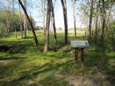
Location. 37° 18.396′ N, 78° 13.565′ W. Marker is in Rice, Virginia, in Amelia County. Marker can be reached from Saylers Creek Road (Virginia Route 617) 0.6 miles north of Scuffletown Road (Virginia Route 620), on the right when traveling north. Located along the Confederate overlook loop trail. Touch for map. Marker is at or near this postal address: 6541 Saylers Creek Road, Rice VA 23966, United States of America. Touch for directions.
Other nearby markers. At least 8 other markers are within walking distance of this marker. Assaulting the Confederate Battle Line (about 700 feet away, measured in a direct line); The Final Clash: With Fate Against Them (approx. 0.2 miles away); Ewell’s Line of Defense (approx. ¼ mile away); Victory or Death (approx. 0.3 miles away); Battle of Sailors Creek (approx. 0.3 miles away); Battle of Sailor's (Sayler's) Creek (approx. 0.4 miles away); Overton / Hillsman House (approx. 0.4 miles away); Hillsman House (approx. 0.4 miles away). Touch for a list and map of all markers in Rice.
Also see . . . Sailor's Creek Battlefield Historical State Park. Virginia Department of Conservation & Recreation (Submitted on April 15, 2012, by Bernard Fisher of Richmond, Virginia.)
Credits. This page was last revised on June 16, 2016. It was originally submitted on April 15, 2012, by Bernard Fisher of Richmond, Virginia. This page has been viewed 1,109 times since then and 35 times this year. Photos: 1, 2, 3. submitted on April 15, 2012, by Bernard Fisher of Richmond, Virginia.


