Central Business District in Lynchburg, Virginia — The American South (Mid-Atlantic)
Lynchburg History
Ninth and Main Streets
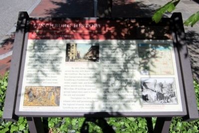
By 1860, three railroads also served the city, with depots near the riverfront. During the Civil War, this transportation network made Lynchburg a Confederate training center, supply base, and hospital center second only to Richmond. More than 30 buildings and many private homes were used to house the sick and wounded.
Throughout the 19th century, tobacco sales and processing fueled the regional economy, making Lynchburg one of the wealthiest cities in the nation. Manufacturing plants along the river made shoes, paper, iron products, and other goods until the mid-1970s.
This intersection has also been a commercial and banking hub for many years. Downtown Lynchburg declined later in the 20th century, as did many other city centers. It has seen a recent rebirth through historic preservation and the adaptive reuse of properties.
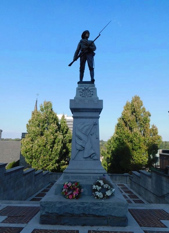
Ninth Street connects the site of Lynch’s Ferry to Monument Terrace, the set of grand stairs and landings behind you that commemorate Lynchburg’s military service. The World War I bronze at the base is Charles Keck’s The Listening Post. Lynchburg’s Confederate memorial statue, erected in 1900, and the Lynchburg Museum are it the top.
(sidebar)
Lynchburg is a city rich in the history of Virginia and the nation. As with any city, some of our sites and buildings that reflect that history have changed over the centuries since Lynchburg’s origins in the 1750s. You can see for yourself the city’s historic places and how they have changed or remained intact. Just let the map guide you to the many historical markers that are located downtown. Enjoy learning about Lynchburg!
The Lynchburg History marker program is a partnership of the City of Lynchburg Museum System, Dept. of Communication & Marketing and Dept. of Parks & Recreation, discoverlynchburg, Lynchburg Historical Foundation, and Lynch’s Landing
Erected 2011 by The Lynchburg History Marker Program.
Topics. This historical marker is listed in these topic lists: Industry & Commerce • Settlements & Settlers • War, US Civil. A significant historical year for this entry is 1757.
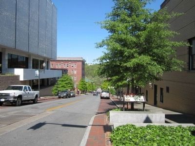
Location. 37° 24.894′ N, 79° 8.525′ W. Marker is in Lynchburg, Virginia. It is in the Central Business District. Marker is at the intersection of Ninth Street and Main Street, on the right when traveling north on Ninth Street. Touch for map. Marker is in this post office area: Lynchburg VA 24504, United States of America. Touch for directions.
Other nearby markers. At least 8 other markers are within walking distance of this marker. Point of Beginning (a few steps from this marker); a different marker also named Lynchburg History (about 300 feet away, measured in a direct line); Nuclear Ship Savannah (about 300 feet away); Lynchburg (about 400 feet away); Carter Glass (about 400 feet away); John Lynch (about 400 feet away); Soldiers, Sailors, and Marines of the Spanish American War (about 500 feet away); World War II (about 500 feet away). Touch for a list and map of all markers in Lynchburg.
More about this marker. On the lower left is an image of a "Tobacco auction, ca. 1910" – Courtesy LynchburgHistory.com
In the center is an image of "Main Street (west) from 9th Street, ca. 1920" Courtesy LynchburgHistory.com
On the lower right is a sketch of "9th Street to courthouse, ca. 1875" Courtesy Lynchburg Museum System
Also see . . .
1. Lynchburg Museum System. (Submitted on April 15, 2012.)
2. Lynchburg History. Historic photos & maps of Lynchburg, VA (Submitted on April 15, 2012.)
Credits. This page was last revised on February 1, 2023. It was originally submitted on April 15, 2012, by Bernard Fisher of Richmond, Virginia. This page has been viewed 720 times since then and 25 times this year. Photos: 1, 2. submitted on April 15, 2012, by Bernard Fisher of Richmond, Virginia. 3. submitted on March 18, 2021, by Bradley Owen of Morgantown, West Virginia.


