Central Business District in Lynchburg, Virginia — The American South (Mid-Atlantic)
Lynchburg History
Commerce Street and Horseford Road
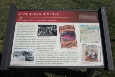
The land along the river was known as the Lower Basin. Boats on the James River and Kanawha Canal docked there between 1840 and 1880. The F.B. Deane, Jr., and Son Foundry, located along the canal, made a variety of munitions for the Confederacy during the Civil War. Craddock-Terry Shoe Company also operated a plant nearby. In recent years, the former manufacturing and commercial buildings have been adapted for use as antique shops, retail stores, and loft apartments.
(sidebar)
Lynchburg is a city rich in the history of Virginia and the nation. As with any city, some of our sites and buildings that reflect that history have changed over the centuries since Lynchburg’s origins in the 1750s. You can see for yourself the city’s historic places and how they have changed or remained intact. Just let the map guide you to the many historical markers that are located downtown. Enjoy learning about Lynchburg!
The Lynchburg History marker program is a partnership of the City of Lynchburg Museum System, Dept. of Communication & Marketing and Dept. of Parks & Recreation, discoverlynchburg, Lynchburg Historical Foundation, and Lynch’s Landing
Erected 2011 by The Lynchburg History Marker Program.
Topics. This historical marker is listed in these topic lists: Industry & Commerce • War, US Civil • Waterways & Vessels. A significant historical year for this entry is 1880.
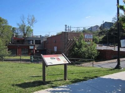
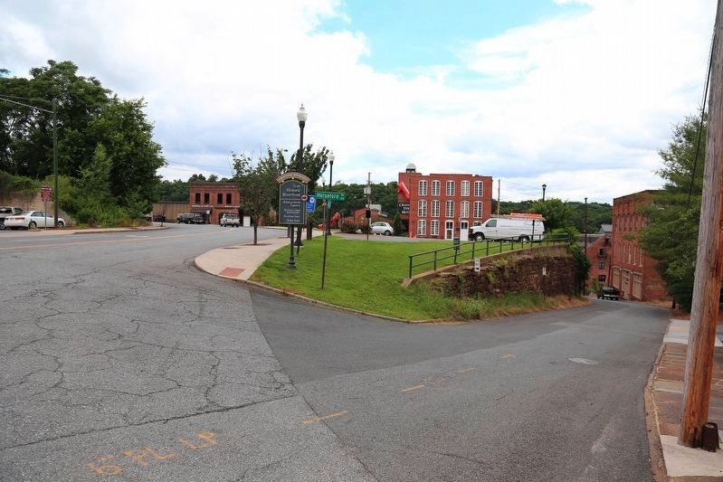
Location. 37° 24.659′ N, 79° 8.301′ W. Marker is in Lynchburg, Virginia. It is in the Central Business District. Marker is at the intersection of Commerce Street and Horseford Road, on the left when traveling south on Commerce Street. Touch for map. Marker is in this post office area: Lynchburg VA 24504, United States of America. Touch for directions.
Other nearby markers. At least 8 other markers are within walking distance of this marker. Lucile Barrow Turner (within shouting distance of this marker); Diamond Hill (about 500 feet away, measured in a direct line); Luke Jordan, Blues Pioneer (about 500 feet away); Cary DeVall Langhorne (1837-1948) (about 700 feet away); a different marker also named Lynchburg History (about 700 feet away); Federal Transient Bureau Fire (about 800 feet away); Lucado House (1902) (approx. 0.2 miles away); Percival's Island Overlook (approx. 0.2 miles away). Touch for a list and map of all markers in Lynchburg.
More about this marker. On the lower left is a photo of "Packet boats on the James River and Kanawha Canal" Courtesy Lynchburg Museum System
In the center is a photo of the "Cutting room, Southland Shoe Factory" Courtesy Lynchburg Museum System
On the right are images of a "Piedmont Mills poster" Courtesy Lynchburg Museum System and a "Tobacco Advertisment" Courtesy Lynchburg Museum System
Also see . . .
1. Lynchburg Museum System. (Submitted on April 15, 2012.)
2. Lynchburg History. Historic photos & maps of Lynchburg, VA (Submitted on April 15, 2012.)
Credits. This page was last revised on February 1, 2023. It was originally submitted on April 15, 2012, by Bernard Fisher of Richmond, Virginia. This page has been viewed 875 times since then and 60 times this year. Photos: 1, 2. submitted on April 15, 2012, by Bernard Fisher of Richmond, Virginia. 3. submitted on June 16, 2017, by J. J. Prats of Powell, Ohio.


