Central Business District in Lynchburg, Virginia — The American South (Mid-Atlantic)
Lynchburg History
Main and Fifth Streets
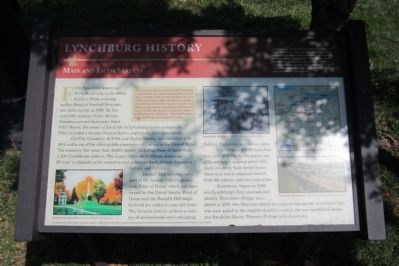
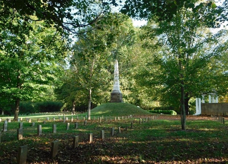
Old City Cemetery, at Fifth and Taylor Streets, was established in 1806 and is one of the oldest public cemeteries still in use in the United States. The cemetery has more than 20,000 graves, including those of more than 2,200 Confederate soldiers. The Legacy Museum of African American History is adjacent to the cemetery and preserves local African American history and culture.
Daniel’s Hill was originally part of Dr. George Cabell’s plantation, Point of Honor, which was later owned by the Daniel family. Point of Honor and the Daniel’s Hill neighborhood are visible to your left front. This historic district reflects a variety of architectural styles including Federal, Italianate, and Queen Anne.
The Garland Hill Historic District just off Fifth Street graces one of Lynchburg’s original seven hills. Early residents built lavish homes there with newly acquired wealth from the tobacco and shoe industries.
Rivermont, begun in 1890, was Lynchburg’s first planned community. Rivermont Bridge, completed in 1891, was then considered an engineering marvel. A streetcar line was soon added to the neighborhood to connect the new residential areas and Randolph-Macon Woman’s College with downtown.
(sidebar)
Lynchburg is a city rich in the history of Virginia and the nation. As with any city, some of our sites and buildings that reflect that history have changed over the centuries since Lynchburg’s origins in the 1750s. You can see for yourself the city’s historic places and how they have changed or remained intact. Just let the map guide you to the many historical markers that are located downtown. Enjoy learning about Lynchburg!
The Lynchburg History marker program is a partnership of the City of Lynchburg Museum System, Dept. of Communication & Marketing and Dept. of Parks & Recreation, discoverlynchburg, Lynchburg Historical Foundation, and Lynch’s Landing
Erected 2011 by The Lynchburg History Marker Program.
Topics. This historical marker is listed in these topic lists: African Americans • Cemeteries & Burial Sites • Industry & Commerce • Railroads & Streetcars. A significant historical year for this entry is 1886.
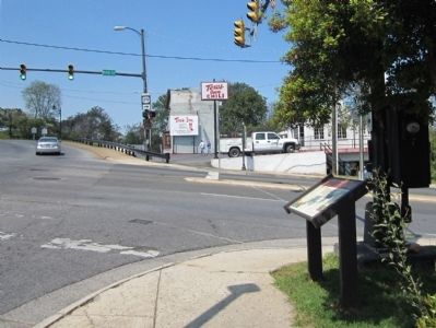
Location. 37° 25.082′ N, 79° 8.7′ W. Marker is in Lynchburg, Virginia. It is in the Central Business District. Marker is on Main Street near Fifth Street (Virginia Route 153), on the right when traveling west. Touch for map. Marker is in this post office area: Lynchburg VA 24504, United States of America. Touch for directions.
Other nearby markers. At least 8 other markers are within walking distance of this marker. The Academy of Music (1905-1958) (a few steps from this marker); Allen Weir Freeman, M.D. (about 300 feet away, measured in a direct line); Douglas Southall Freeman (about 300 feet away); The Ladies Relief Hospital (about 300 feet away); a different marker also named The Ladies Relief Hospital (about 300 feet away); a different marker also named Lynchburg History (about 400 feet away); Court Street Baptist Church (about 700 feet away); Elizabeth Langhorne Lewis (approx. 0.2 miles away). Touch for a list and map of all markers in Lynchburg.
More about this marker. On the lower left is an image of the "Confederate Section" - Courtesy Old City Cemetery
In the center is a photo of a "Lynchburg streetcar" - Courtesy LynchburgHistory.com
On the lower right is an image of the "Bridge to Rivermont" - Courtesy Lynchburg Museum System
Also see . . .
1. Lynchburg Museum System. (Submitted on April 15, 2012.)
2. Lynchburg History. Historic photos & maps of Lynchburg, VA (Submitted on April 15, 2012.)
3. Fifth Street Historic District. National Register of Historic Places (Submitted on November 9, 2021.)
Credits. This page was last revised on February 1, 2023. It was originally submitted on April 15, 2012, by Bernard Fisher of Richmond, Virginia. This page has been viewed 685 times since then and 19 times this year. Photos: 1, 2. submitted on April 15, 2012, by Bernard Fisher of Richmond, Virginia. 3. submitted on March 18, 2021, by Bradley Owen of Morgantown, West Virginia.


