Near Locust Grove in Spotsylvania County, Virginia — The American South (Mid-Atlantic)
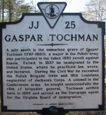
Gaspar Tochman
Erected 1992 by Department of Historic Resources. (Marker Number JJ-25.)
Topics and series. This historical marker is listed in this topic list: War, US Civil. In addition, it is included in the Virginia Department of Historic Resources (DHR) series list. A significant historical year for this entry is 1830.
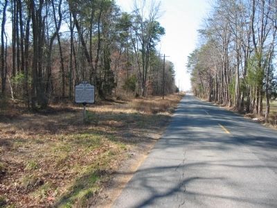
Location. Marker has been reported missing. It was located near 38° 16.491′ N, 77° 45.501′ W. Marker was near Locust Grove, Virginia, in Spotsylvania County. Marker was at the intersection of Orange Plank Road (County Route 621) and Parker Road (County Route 611) on Orange Plank Road. Touch for map. Marker was at or near this postal address: 12212 Orange Plank Rd, Locust Grove VA 22508, United States of America. Touch for directions.
Other nearby markers. At least 8 other markers are within 2 miles of this location, measured as the crow flies. A.P. Hill Escapes Capture (approx. 1˝ miles away); Key Terrain (approx. 1˝ miles away); Wilderness Campaign (approx. 1.6 miles away); The Chewning Farm (approx. 1.6 miles away); a different marker also named Wilderness Campaign (approx. 2 miles away); Lee-to-the-Rear (approx. 2 miles away); In the Nick of Time (approx. 2 miles away); In The Nick of Time (approx. 2 miles away). Touch for a list and map of all markers in Locust Grove.
Additional commentary.
1. The Polish Brigade
Despite the name, the Polish Brigade was not exclusively Polish. Exiles from Europe, feeling from the political and revolutionary strife of the mid-century, joined this organization. Although the organization served during the major campaigns of the Civil War in Virginia, the exiles were never quite fully embraced by the military and political leaders of the Confederacy.
— Submitted February 17, 2008, by Craig Swain of Leesburg, Virginia.
Credits. This page was last revised on July 9, 2021. It was originally submitted on February 17, 2008, by Craig Swain of Leesburg, Virginia. This page has been viewed 937 times since then and 49 times this year. Photos: 1, 2. submitted on February 17, 2008, by Craig Swain of Leesburg, Virginia.

