Near Sharpsburg in Washington County, Maryland — The American Northeast (Mid-Atlantic)
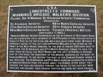
Longstreet's Command
Manning's Brigade, Walker's Division
Longstreet's Command
Manning's Brigade, Walker's Division
Colonel Van H. Manning, 3d Arkansas Infantry, Commanding.
Organization
3d Arkansas Infantry 48th North Carolina Infantry
27th North Carolina Infantry 30th Virginia Infantry
46th North Carolina Infantry French's (Va.) Battery
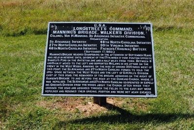
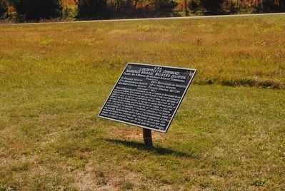
Manning's Brigade reached Sharpsburg on the afternoon of September 16, and was held in reserve until daybreak of the 17th, when it took position opposite Snavely's Ford on the Antietam, one and a half miles from town. Between 8 and 9 A.M. it moved to the left and supported McLaws in his attack on the enemy in the West Woods. Arriving on the rise of ground 300 yards west of this point, 3d Arkansas and 27th North Carolina formed to hold the open space between the West Woods and the left of D. H. Hill's Division east of this road. The remainder of the Brigade advancing on the right of Ransom's Brigade to and beyond the road at the Dunkard Church, where it was repulsed. The 3d Arkansas and 27th North Carolina co-operated in expelling Greene's Division from the woods about the Church, after which they crossed the road and advanced through the fields to the east, but were repulsed and resumed their original position and were not again engaged.
Erected by Antietam Battlefield Board. (Marker Number 367.)
Topics and series. This historical marker is listed in this topic list: War, US Civil. In addition, it is included in the Antietam Campaign War Department Markers series list. A significant historical date for this entry is September 17, 1862.
Location. 39° 28.301′ N, 77° 44.731′ W. Marker is near Sharpsburg, Maryland, in Washington County. Marker is at the intersection of Hagerstown Pike (State Highway 65) and Richardson Avenue, on the right when traveling north on Hagerstown Pike. Located just short of the entrance to the Antietam National Battlefield Park visitors center. Touch for map. Marker is in this post office area: Sharpsburg MD 21782, United States of America. Touch for directions.
Other nearby markers. At least 10 other markers are within walking distance of this marker. A different marker also named Longstreet's Command (about 300 feet away, measured in a direct line); a different marker also named Longstreet's Command (about 400 feet away); Colquitt's and Garland's Brigades (about 600 feet away); O.T. Reilly Monument (about 700 feet away); D.H. Hill's Division, Jackson's Command (about 700 feet away); Old Vermont Brigade (about 800 feet away); The Maryland Campaign of 1862 (approx. 0.2 miles away); A Deadly Struggle (approx. 0.2 miles away); 3rd Maryland Volunteer Infantry (approx. 0.2 miles away); Battlefield Namesake (approx. 0.2 miles away). Touch for a list and map of all markers in Sharpsburg.
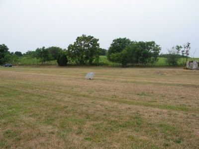
More about this marker. This marker did stand on private property across the highway, but was re-located sometime after 1960 to its present location.
Related markers. Click here for a list of markers that are related to this marker. Manning's Brigade War Department Markers
Also see . . .
1. Antietam Battlefield. National Park Service site. (Submitted on February 17, 2008, by Craig Swain of Leesburg, Virginia.)
2. Walker's Brigade. The Brigade is often called by its original commander's name. When General John G. Walker moved up to command the Division, Manning was placed in command. Manning was wounded during this battle and the Brigade command fell to Col. E.D. Hall of the 46th North Carolina Infantry. However, Hall was unable gather control of the scattered brigade. (Submitted on February 17, 2008, by Craig Swain of Leesburg, Virginia.)
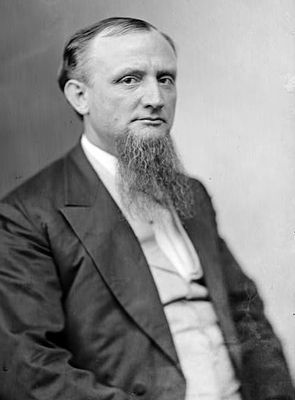
3. Van H. Manning. Vannoy Hartrog (Van) Manning (July 26, 1839 – November 3, 1892) was an attorney, an officer in the Confederate Army of Northern Virginia during the American Civil War, reaching the rank of colonel; and a politician. (Submitted on October 25, 2015, by Brian Scott of Anderson, South Carolina.)
4. 27th North Carolina Infantry. Antietam on the Web entry (Submitted on April 2, 2022, by Larry Gertner of New York, New York.)
Photographed By Craig Swain, September 17, 2007
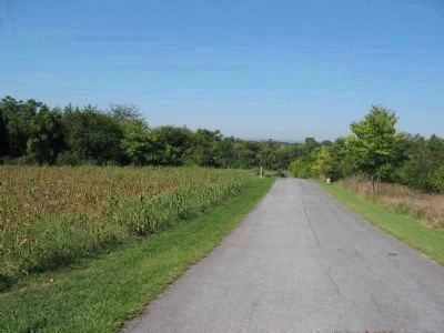
6. Manning's Brigade Line of Advance
Manning's Brigade initially advanced over this ridge (marching toward the camera) to a position near the Dunker Church. The road seen here is a modern addition to the battlefield, an extension to the Smoketown Road. From here, portions of the brigade were sent to the north of the Dunker Church (the 46th and 48th North Carolina). The 30th Virginia remained nearby. The 27th North Carolina and the 3rd Arkansas moved south of the Dunker Church.
Photographed By Craig Swain, March 29, 2008
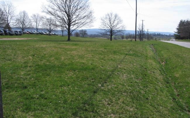
7. 27th North Carolina and 3rd Arkansas
At around noon, as part of a Confederate counterattack to clear Greene's Division from their foothold around the Dunker Church, the 27th N.C. and 3rd Ark. attacked east toward the Hagerstown Pike, crossing at a point opposite the visitors center parking lot (here on the left). The attack drove the Federals, who were running short of ammunition, out of the West Woods for good. Following directly on their heels, the two regiments drove through a soft spot in the Federal lines. After overtaking part of Owen's Rhode Island Battery, the two regiments continued forward past the Mumma's Lane and nearly to the Sunken Lane. Unsupported, the Confederates fell back, but not before causing much disruption in the Federal lines.
Credits. This page was last revised on April 2, 2022. It was originally submitted on February 17, 2008, by Craig Swain of Leesburg, Virginia. This page has been viewed 934 times since then and 14 times this year. Photos: 1. submitted on February 17, 2008, by Craig Swain of Leesburg, Virginia. 2. submitted on October 25, 2015, by Brian Scott of Anderson, South Carolina. 3. submitted on February 17, 2008, by Craig Swain of Leesburg, Virginia. 4, 5. submitted on October 25, 2015, by Brian Scott of Anderson, South Carolina. 6. submitted on February 17, 2008, by Craig Swain of Leesburg, Virginia. 7. submitted on April 5, 2008, by Craig Swain of Leesburg, Virginia.
