Sullivan in Hancock County, Maine — The American Northeast (New England)
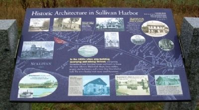
Historic Architecture in Sullivan Harbor
Inscription.
In the 1800s when ship building, quarrying and mining thrived, enterprising businessmen built boarding houses and hotels to house the many laborers. Blacksmith shops, livery stables, grocery and feed stores, and a meat shop flourished as well. The town bustled with many small businesses.
The history of the stores in Sullivan mirror its economy. When shipbuilding and fishing gave way to granite quarrying and briefly to mining, we find many new stores in West Sullivan - often company stores owned by mine or quarry owners. There has been a Country Store here since before 1889. Originally it was located across Rt. 1 behind you.
[Photo captions follow]
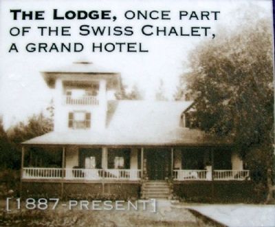
[1.] The Lodge, once part of the Swiss Chalet, a grand hotel, 1887-Present
[2.] Fire burned both Dunbar's Store and this attached house in 1933
[3.] The Hotel Bristol closed in 1923 when a buyer bought it to have it demolished because "it obstructed her view of the bay" [1887-1923]
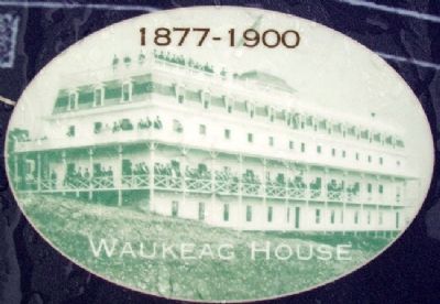
[4.] Waukeag House, 1887-1900
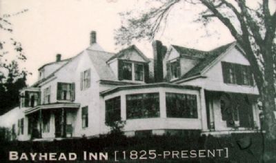
[5.] Bayhead Inn [1825-Present]
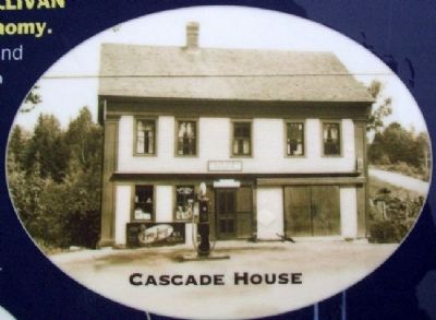
[6.] Cascade House, Built as an inn or boarding house. Later converted to grain, feed and grocery stores. At intersection of Rt. 200 and Rt. 1.
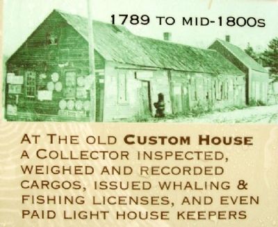
[7.] At the old Custom House a collector inspected, weighted and recorded cargos, issued whaling & fishing licenses, and even paid light house keepers, 1789 to mid-1800s
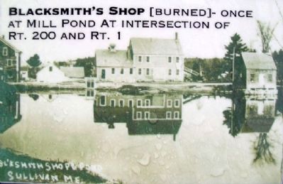
[8.] Blacksmith's Shop [burned] - once at Mill Pond at intersection of Rt. 200 and Rt. 1
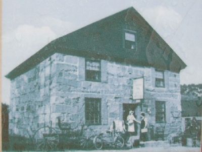
[9.] The Old Granite Store, Built to keep salt for fisherman [sic] braving the Grand Banks. Look for it on Route 1 a short way from here on the water side
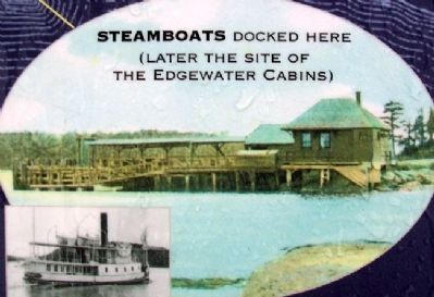
[10.] Steamboats docked here (later the site of the Edgewater Cabins)
Erected by Maine Department of Transportation.
Topics. This historical marker is listed in these topic lists: Architecture • Industry & Commerce • Waterways & Vessels. A significant historical year for this entry is 1889.
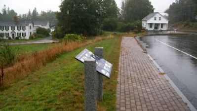
Location. 44° 31.349′ N, 68° 12.572′ W. Marker is in Sullivan, Maine, in Hancock County. Marker is on U.S. 1 near Benvenuto Avenue, on the right when traveling east. Marker is at a roadside pullout on the south side of U.S. 1. Touch for map. Marker is in this post office area: Sullivan ME 04664, United States of America. Touch for directions.
Other nearby markers. At least 8 other markers are within 5 miles of this marker, measured as the crow flies. Summer Rusticators, the Tourist Trade and the Waukeag House Hotel (a few steps from this marker); The view of Frenchman Bay (within shouting distance of this marker); Defenders of the Union (approx. 2.2 miles away); Franklin Veterans Memorial
(approx. 4.6 miles away); Old Town Hall Site (approx. 4.6 miles away); Civil War Memorial (approx. 4.6 miles away); World War Memorial (approx. 4.6 miles away); Exhibit of the Granite Industry (approx. 4.7 miles away). Touch for a list and map of all markers in Sullivan.
Credits. This page was last revised on October 31, 2020. It was originally submitted on April 22, 2012, by William Fischer, Jr. of Scranton, Pennsylvania. This page has been viewed 804 times since then and 33 times this year. Photos: 1, 2, 3, 4, 5, 6, 7, 8, 9, 10, 11, 12. submitted on April 22, 2012, by William Fischer, Jr. of Scranton, Pennsylvania.
