Greenbrier West in Chesapeake, Virginia — The American South (Mid-Atlantic)
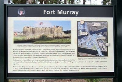
Fort Murray
On his way to try to establish a base of operations in Norfolk, the governor conducted raids in Norfolk and Princess Anne Counties, including a brief skirmish at Kemp’s Landing on November 14th. The patriot “shirtmen” were easily routed and two officers were captured.
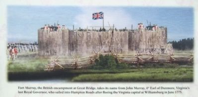
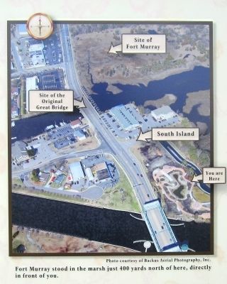
Because Great Bridge provided the only landward approach to Norfolk, Dunmore issued an order on November 14th for construction of a small stockade fort on an island north of the bridge and east of the causeway that crossed nearly a half mile of swamp. Aptly named Fort Murray, it was garrisoned by a unit of regular troops, a group of volunteers called the Queen’s Own Loyal Virginia Regiment, and a number of runaway slaves.
Erected 2012 by Great Bridge Battlefield & Waterways History Foundation.
Topics. This historical marker is listed in these topic lists: Forts and Castles • War, US Revolutionary. A significant historical month for this entry is November 1839.
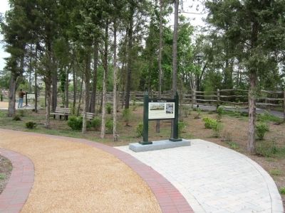
Location. 36° 43.307′ N, 76° 14.356′ W. Marker is in Chesapeake, Virginia. It is in Greenbrier West. Marker can be reached from the intersection of North Battlefield Boulevard (Business Virginia Route 168) and Watson Road, on the left when traveling south. Touch for map. Marker is in this post office area: Chesapeake VA 23320, United States of America. Touch for directions.
Other nearby markers. At least 8 other markers are within walking distance of this marker. Liberty to Slaves (a few steps from this marker); The Day is Our Own! (within shouting distance of this marker); Causeway Construction (within shouting distance of this marker); Causeways (within shouting distance of this marker); Billy Flora (within shouting distance of this marker); Site of the Original Causeway (within shouting distance of this marker); At Dawn On December 9, 1775 (within shouting distance of this marker); First Fire (within shouting distance of this marker). Touch for a list and map of all markers in Chesapeake.
Also see . . . Great Bridge Battlefield & Waterways History Foundation. (Submitted on April 29, 2012, by Bernard Fisher of Richmond, Virginia.)
Credits. This page was last revised on February 1, 2023. It was originally submitted on April 29, 2012, by Bernard Fisher of Richmond, Virginia. This page has been viewed 2,163 times since then and 109 times this year. Photos: 1, 2, 3, 4. submitted on April 29, 2012, by Bernard Fisher of Richmond, Virginia.


