Near Lakeland in Lanier County, Georgia — The American South (South Atlantic)
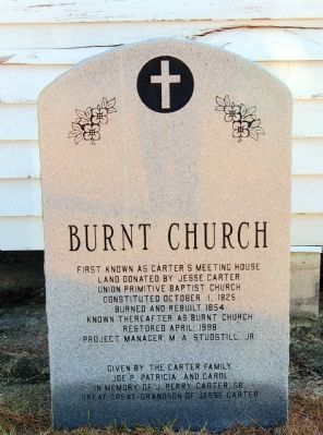
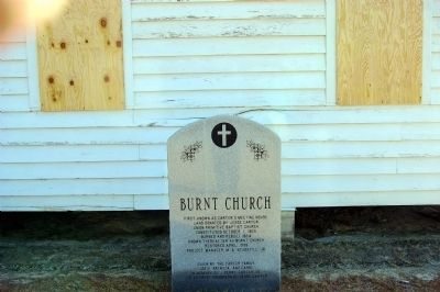
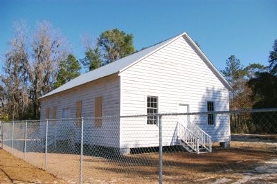
Burnt Church
Land donated by Jesse Carter
Union Primitive Baptist Church
Constituted October 1, 1825
Burnt and rebuilt 1854
Known thereafter as Burnt Church
Restored April 1998
Project Manager M. A. Studstill, Jr.
Given by the Carter Family
Joe P., Patricia, and Carol
In Memory of J. Perry Carter, Sr.
Great-Grandson of Jesse Carter
Erected by The Carter Family.
Topics. This historical marker is listed in this topic list: Churches & Religion. A significant historical year for this entry is 1825.
Location. 31° 1.479′ N, 83° 2.921′ W. Marker is near Lakeland, Georgia, in Lanier County. Marker is on Burnt Church Road, 0.7 miles east of College Street (Route 135), on the left when traveling east. Burnt Church Road is just south of the Lakeland City Limits sign on College Avenue. Touch for map. Marker is in this post office area: Lakeland GA 31635, United States of America. Touch for directions.
Other nearby markers. At least 8 other markers are within 2 miles of this marker, measured as the crow flies. Union Church Cemetery (within shouting distance of this marker); Union Baptist Church (approx. one mile away); Fender Cemetery (approx. 1.8 miles away); The Milltown Air Line Locomotive (approx. 1.9 miles away); The Hotel Milltown (approx. 1.9 miles away); M. E. Johnson (approx. 1.9 miles away); Stapleton's Grocery (approx. 1.9 miles away); Oaklawn Baptist Academy (approx. 1.9 miles away). Touch for a list and map of all markers in Lakeland.
Credits. This page was last revised on June 16, 2016. It was originally submitted on March 2, 2010, by David Seibert of Sandy Springs, Georgia. This page has been viewed 2,230 times since then and 33 times this year. Last updated on April 29, 2012, by David Seibert of Sandy Springs, Georgia. Photos: 1, 2, 3. submitted on March 2, 2010, by David Seibert of Sandy Springs, Georgia. • Craig Swain was the editor who published this page.


