Catonsville in Baltimore County, Maryland — The American Northeast (Mid-Atlantic)
Catonsville
A Turnpike Town
— The Historic National Road - The Road That Built The Nation —
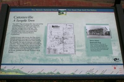
Typical of many pike towns, the Plan shows that the majority of properties and buildings are directly adjacent to the road, thus making the Turnpike the hub of economic and social activities. Many of the more affluent residents, who enjoyed Catonsville as a retreat from the summer heat of Baltimore, built their estates a short distance from the Turnpike to allow for lawns, gardens and lavish Victorian-style homes.
(Sidebar):
Remus Adams Blacksmith Shop
Remus Adams, a “free man of color,” owned a blacksmith shop on the National Road before the Civil War. Today, his property has become the site of the Catonsville Elementary School.
Erected by America's Byways.
Topics and series. This historical marker is listed in these topic lists: African Americans • Roads & Vehicles. In addition, it is included in the The Historic National Road series list. A significant historical year for this entry is 1877.
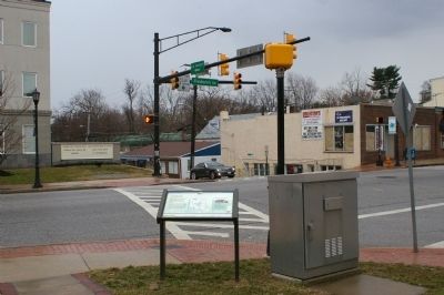
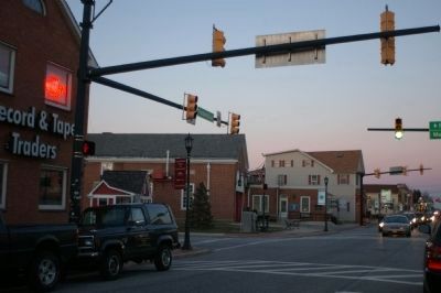
Location. 39° 16.308′ N, 76° 44.012′ W. Marker is in Catonsville, Maryland, in Baltimore County. Marker is at the intersection of Frederick Road (Maryland Route 144) and Egges Lane on Frederick Road. Touch for map. Marker is in this post office area: Catonsville MD 21228, United States of America. Touch for directions.
Other nearby markers. At least 8 other markers are within walking distance of this marker. Catonsville Veterans Memorial (about 300 feet away, measured in a direct line); A Civil Rights Milestone (approx. 0.3 miles away); Castle Thunder (approx. 0.3 miles away); Catonsville Nine (approx. 0.3 miles away); 6-Mile Marker on the National Road (approx. 0.4 miles away); Baltimore Regional Trail (approx. 0.4 miles away); Rolling Road (approx. 0.7 miles away); The Streetcar Era in Catonsville (approx. ¾ mile away). Touch for a list and map of all markers in Catonsville.
More about this marker. The center of the marker displays a plat of the town of Catonsville. In the sidebar is a photo of Remus Adams blacksmith shop. The background of the marker is "National Road at Fairview Inn" which is the standard for markers in this series. An elevation diagram of the national road is displayed on the bottom of the marker's face.
Additional commentary.
1. Eight miles, or a one day carriage ride
You say Catonsville was “only eight miles, or a one-day carriage ride” from Baltimore. Horses walk at 3 to 4 mph. That would make it a two hour to 2 hours 40 minutes carriage ride. Hardly a day’s ride.
I’ve heard it said that Frederick (40 miles away) was one day’s carriage ride out from Baltimore. 4 mph x 10 hours on the road.
— Submitted February 18, 2008, by Peter Samuel of Frederick, Maryland.
2. Eight miles, or a one day carriage ride
A horse might have carried a rider at speed, but a carriage on a rutted and/or muddy road dodging livestock on their way to market might have traveled much more slowly on the average.
— Submitted February 19, 2008, by J. J. Prats of Powell, Ohio.
Credits. This page was last revised on March 24, 2024. It was originally submitted on February 18, 2008, by Christopher Busta-Peck of Shaker Heights, Ohio. This page has been viewed 1,664 times since then and 38 times this year. Photos: 1, 2. submitted on February 18, 2008, by Christopher Busta-Peck of Shaker Heights, Ohio. 3. submitted on March 1, 2008, by Christopher Busta-Peck of Shaker Heights, Ohio. • Craig Swain was the editor who published this page.


