Monterey in Monterey County, California — The American West (Pacific Coastal)
Monterey Breakwater
Historic Cannery Row

Photographed By Barry Swackhamer, April 23, 2012
1. Monterey Breakwater Marker
[Photograph captions]
[Top]
Photograph by A.C. Heidick, courtesy of the Monterey Public Library, California History Room
[Middle]
Photograph courtesy of the Monterey Public Library, California History Room
[Bottom]
Photograph courtesy of the Monterey Public Library, California History Room.
[Top]
Photograph by A.C. Heidick, courtesy of the Monterey Public Library, California History Room
[Middle]
Photograph courtesy of the Monterey Public Library, California History Room
[Bottom]
Photograph courtesy of the Monterey Public Library, California History Room.
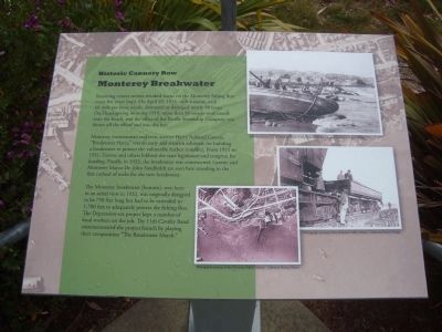
Recurring winter storms wreaked havoc on the Monterey fishing fleet every few years (top). On April 29, 1915, such a storm, with 60-mile-per-hour winds, destroyed or damaged nearly 50 boats. On Thanksgiving morning 1919, more than 93 vessels were tossed onto the beach, and the offices of the Pacific Steamship Company was blown off the wharf and into the bay.
Monterey businessman and civic activist Harry Ashland Greene, “Breakwater Harry,” was an early and staunch advocate for building a breakwater to protect the vulnerable harbor (middle). From 1911 to 1931, Greene and others lobbied the state legislature and congress for funding. Finally, in 1932, the breakwater was constructed. Greene and Monterey Mayor Dr. John Sandholdt are seen standing in the first carload of rocks for the new breakwater.
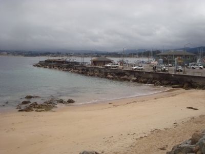
The Monterey breakwater (bottom), seen here in an aerial view in 1932, was originally designed to be 750 feet long but had to be extended to 1,700 feet to adequately protect the fishing fleet. The Depression-era project kept a number of local workers on the job. The 11th Cavalry Band commemorated the project launch by playing their composition “The Breakwater March.”
Topics. This historical marker is listed in these topic lists: Animals • Disasters • Industry & Commerce • Waterways & Vessels. A significant historical month for this entry is April 1880.
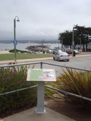
Location. 36° 36.581′ N, 121° 53.795′ W. Marker is in Monterey, California, in Monterey County. Marker can be reached from Cannery Row. The marker is located on the ocean side of the Monterey Recreational Trail in San Carlos Beach Park. Touch for map. Marker is in this post office area: Monterey CA 93940, United States of America. Touch for directions.
Other nearby markers. At least 8 other markers are within walking distance of this marker. Associated Oil Fire – 1924 (within shouting distance of this marker); Trains and Canneries (within shouting distance of this marker); Cannery Divers Memorial (within shouting distance of this marker); The California Riviera (approx. 0.2 miles away); Sloat Monument (approx. 0.2 miles away); Presidio of Monterey Museum (approx. 0.2 miles away); Edward Ricketts (approx. 0.2 miles away); Fort Mervine (approx. ¼ mile away). Touch for a list and map of all markers in Monterey.
Also see . . . Diving Monterey's Breakwater - California Diver. The Breakwater in Monterey is a well-known dive spot where many new divers complete their open water checkout dives – and for good reason. It’s well protected from ocean swells, making it possible to dive almost every day of the year. It’s gently sloping, sandy shoreline provides an easy entry and exit, and underwater, the slope continues a gradual descent to a maximum depth of 40-50 feet. (Submitted on May 10, 2012, by Barry Swackhamer of Brentwood, California.)
Credits. This page was last revised on August 17, 2020. It was originally submitted on May 10, 2012, by Barry Swackhamer of Brentwood, California. This page has been viewed 1,052 times since then and 15 times this year. Photos: 1, 2, 3, 4. submitted on May 10, 2012, by Barry Swackhamer of Brentwood, California. • Syd Whittle was the editor who published this page.


