Near Paxico in Wabaunsee County, Kansas — The American Midwest (Upper Plains)
Historical Kansas
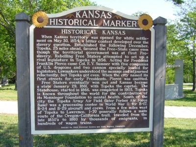
When Kansas territory was opened for white settlement on May 30, 1854, a bitter contest developed over the slavery question. Established the following December, Topeka, 25 miles ahead, favored the Free-State cause even though the territorial government was at first Pro-slavery. Rebelling Free Staters attempted to set up a rival legislature in Topeka in 1856. Acting for President Franklin Pierce came Col. E. V. Sumner with five companies of U. S. dragoons and two cannon specially loaded for legislators. Lawmakers understood the message and adjourned reluctantly, but Topeka got even. When the city named its first streets for early Presidents, Pierce was omitted.
Free Staters eventually won out and Kansas became a state January 29, 1861, with Topeka the capital. The Statehouse, started in 1866, was completed in 1903. Topeka is known throughout the world for the contribution of its Menninger Foundation to mental health. South of the city the Topeka Army Air Field (later Forbes Air Force Base) was a processing center in World War II for B-17, B-24 and B-29 aircraft and crews. From a few miles west of Topeka to Lawrence, I-70 generally follows a main route of the Oregon-California trail, traveled from the late 1830's to 1860 by thousands of emigrants, in hundreds of wagon trains.
Erected by State Historical Society and State Highway Commission. (Marker Number 106.)
Topics and series. This historical marker is listed in this topic list: Settlements & Settlers. In addition, it is included in the Former U.S. Presidents: #14 Franklin Pierce, and the Kansas Historical Society series lists. A significant historical date for this entry is January 29, 1850.
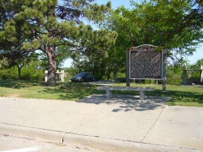
Location. 39° 3.549′ N, 96° 7.229′ W. Marker is near Paxico, Kansas, in Wabaunsee County. Marker can be reached from Interstate 70 at milepost 337. Marker is in the east bound rest area. Touch for map. Marker is in this post office area: Paxico KS 66526, United States of America. Touch for directions.
Other nearby markers. At least 8 other markers are within 10 miles of this marker, measured as the crow flies. Bluestem in the Flint Hills / Beecher Bibles (about 400 feet away, measured in a direct line); Veterans Memorial (approx. 9 miles away); Soldiers and Sailors Memorial (American Legion Post) (approx. 9.6 miles away); Brandt Hotel (approx. 9.6 miles away); Limerick Building (approx. 9.6 miles away); Mueller Block (approx. 9.6 miles away); St. Marys (approx. 9.6 miles away); The Great Military Road (approx. 9.6 miles away).
Credits. This page was last revised on August 3, 2020. It was originally submitted on May 14, 2012, by Bill Kirchner of Tucson, Arizona. This page has been viewed 557 times since then and 5 times this year. Photos: 1, 2. submitted on May 14, 2012, by Bill Kirchner of Tucson, Arizona. • Bill Pfingsten was the editor who published this page.

