Near Summerhaven in Pima County, Arizona — The American Mountains (Southwest)
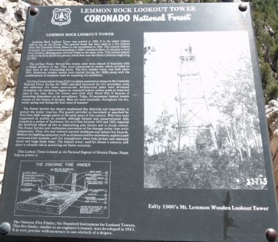
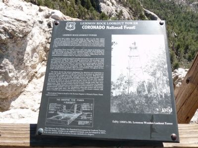
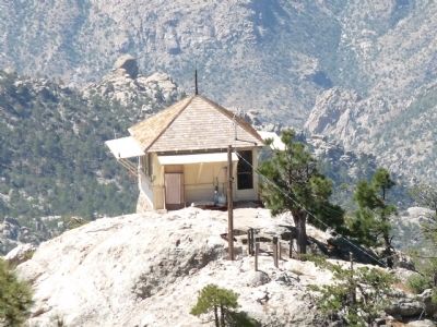
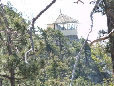
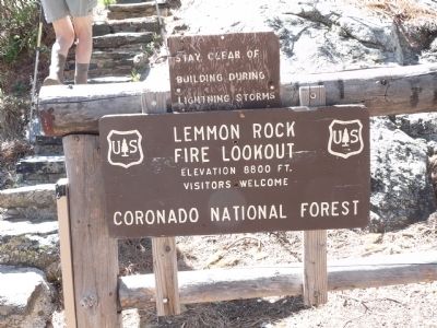
Lemmon Rock Lookout Tower
Coronado National Forest
The earliest Forest Service fire towers were trees cleared of branches with a simple platform on top. They were constructed in locales which provided an open view of the surrounding forest. The first wooden tower was built about 1915. Numerous wooden towers were erected during the 1920's, along with the establishment of telephone lines for reporting fire conditions.
Civilian Conservation Corps (CCC) enrollees stationed at camps on the Coronado National Forest during the 1930's provided personnel for fire prevention work and additional fire tower construction. Architectural plans were developed throughout the Southwest Region for standard lookout towers made of wood and steel at this time. Few fire towers were built after World War II because of increasing dependence on air surveillance. Today, 50 permanent lookout towers remain on the forests of Arizona. Most are used seasonally, throughout the dry, windy spring and during the first rains of summer.
The Forest Service has always emphasized fire detection and suppression to protect the timber reserves. Fire guards patrolled on horseback or searched for fires from high vantage points in the early years of this century. Wild fires were suppressed as quickly as possible, although forester and conservationist Aldo Leopold, in a review of Southwest fire activities between 1919 and 1923, reported the beneficial effects of fire in maintaining pine forests and in brush control. The Forest Service now emphasizes prevention of fire damage rather than strict suppression. Thus, fire may enhance natural conditions and reduce fire hazards. Modern fire fighting equipment such as airplanes and fire retardants, sophisticated communication systems, and fire management plans help protect and maintain forest and range lands today. The lookout tower, used for almost a century, still plays a valuable role in protecting our forest resources.
This Lookout Tower is listed on the National Register of Historic Place. Please help us to protect it.
Erected by Coronado National Forest.
Topics and series. This historical marker is listed in these topic lists: Disasters • Horticulture & Forestry. In addition, it is included in the Civilian Conservation Corps (CCC) series list. A significant historical year for this entry is 1928.
Location. 32° 26.102′ N, 110° 47.364′ W. Marker is near Summerhaven, Arizona, in Pima County. It is a short (0.6 mile) hike to reach the Lemmon Rock Lookout Tower Marker.
Directions to hike: Take the Catalina Highway off Tanque Verde Road in Tucson. Drive 4.2 miles to the Forest boundary and continue 28 miles, past Mt. Lemmon Ski Valley, to the power substation on Radio Ridge. A parking area is on the left, about a mile past Mt. Lemmon Ski Valley, near the end of Observatory Road.
From the parking area follow the Mt. Lemmon trail, on the south side of the power substation, 0.45 miles southwest to the Lemmon Rock Lookout trail. Turn left and follow the Lemmon Rock Lookout trail 0.15 miles south to the Lookout Tower. Touch for map. Marker is in this post office area: Mount Lemmon AZ 85619, United States of America. Touch for directions.
Other nearby markers. At least 8 other markers are within 12 miles of this marker, measured as the crow flies. The San Pedro River Valley (approx. 6.3 miles away); Honorable Frank Harris Hitchcock (approx. 6.3 miles away); Catalina Federal Honor Camp (approx. 7.8 miles away); DeGrazia Gallery In the Sun
(approx. 9.9 miles away); La Casa Del High Jinks (approx. 9.9 miles away); American Flag (approx. 10.8 miles away); Agua Caliente Ranch and Hot Springs (approx. 11.2 miles away); Tucson (approx. 11.2 miles away).
Credits. This page was last revised on June 16, 2016. It was originally submitted on May 21, 2012, by Bill Kirchner of Tucson, Arizona. This page has been viewed 1,959 times since then and 90 times this year. Photos: 1, 2, 3, 4, 5, 6, 7. submitted on May 21, 2012, by Bill Kirchner of Tucson, Arizona. • Syd Whittle was the editor who published this page.
