Evanston in Cook County, Illinois — The American Midwest (Great Lakes)
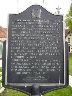
Archange Ouilmette
“This tract to have and to hold for Archange and children, never to be leased or conveyed unless by permission of the President of the United States.”
Erected by Evanston Park Board, Evanston Historical Society.
Topics. This historical marker is listed in these topic lists: Native Americans • Peace • Women. A significant historical year for this entry is 1829.
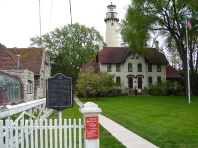
Location. 42° 3.842′ N, 87° 40.613′ W. Marker is in Evanston, Illinois, in Cook County. Marker is at the intersection of Sheridan Road and Central Street, on the right when traveling north on Sheridan Road. Touch for map. Marker is at or near this postal address: 2601 Sheridan Road, Evanston IL 60201, United States of America. Touch for directions.
Other nearby markers. At least 8 other markers are within 4 miles of this marker, measured as the crow flies. Grosse Point Light Station (within shouting distance of this marker); The Baha'i House Of Worship And Welcome Center (approx. 0.8 miles away); Residence of Charles Gates Dawes (approx. 1˝ miles away); Indian Boundary Lines (approx. 3.3 miles away); Emil Bach House (approx. 3.3 miles away); Burr Tillstrom (approx. 3.4 miles away); Indian Boundary Village (approx. 3.8 miles away); Indian Boundary Park (approx. 3.9 miles away). Touch for a list and map of all markers in Evanston.
Credits. This page was last revised on January 30, 2023. It was originally submitted on May 22, 2012, by Bill Kirchner of Tucson, Arizona. This page has been viewed 885 times since then and 15 times this year. Photos: 1, 2. submitted on May 22, 2012, by Bill Kirchner of Tucson, Arizona. • Bernard Fisher was the editor who published this page.

