White Deer in Carson County, Texas — The American South (West South Central)
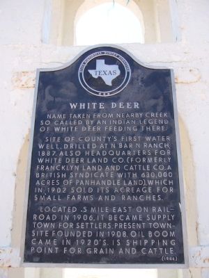
White Deer
Site of county's first water well, drilled at N Bar N Ranch, 1887. Also headquarters for White Deer Land Co. (formerly Francklyn Land and Cattle Co., a British syndicate with 630,000 acres of Panhandle land), which in 1902 sold its acreage for small farms and ranches.
Located .5 mile east on railroad in 1906, it became supply town for settlers. Present townsite founded in 1908. Oil boom came in 1920's. Is shipping point for grain and cattle.
Erected 1966 by State Historical Survey Committee. (Marker Number 5781.)
Topics. This historical marker is listed in this topic list: Settlements & Settlers. A significant historical year for this entry is 1887.
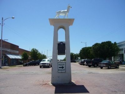
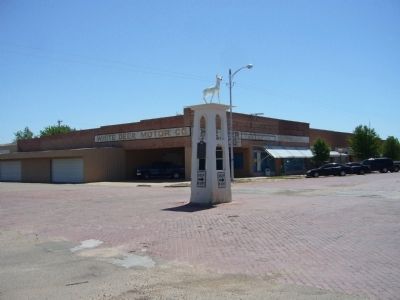
Location. 35° 26.061′ N, 101° 10.355′ W. Marker is in White Deer, Texas, in Carson County. Marker is at the intersection of South Main Street and 3rd Avenue, in the median on South Main Street. Marker is at base of White Deer Statue, in middle of intersection. Touch for map. Marker is in this post office area: White Deer TX 79097, United States of America. Touch for directions.
Other nearby markers. At least 8 other markers are within walking distance of this marker. Jackson General Store (about 300 feet away, measured in a direct line); Hotel at White Deer (about 500 feet away); First Baptist Church of White Deer (about 700 feet away); First Presbyterian Church (approx. 0.2 miles away); White Deer United Methodist Church (approx. 0.4 miles away); White Deer Sacred Heart Catholic Church (approx. 0.4 miles away); Polish Settlers (approx. 0.4 miles away); Sacred Heart Catholic Cemetery (approx. 0.7 miles away). Touch for a list and map of all markers in White Deer.
Credits. This page was last revised on June 16, 2016. It was originally submitted on May 31, 2012, by Bill Kirchner of Tucson, Arizona. This page has been viewed 606 times since then and 18 times this year. Photos: 1, 2, 3. submitted on May 31, 2012, by Bill Kirchner of Tucson, Arizona. • Bernard Fisher was the editor who published this page.


