Panhandle in Carson County, Texas — The American South (West South Central)
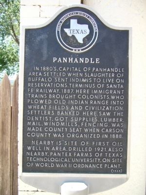
Panhandle
Nearby is site of first oil well in area, drilled 1921. Also nearby, Pantex Farms of Texas Technological University, on site of World War II Ordnance Plant.
Erected 1965 by State Historical Survey Committee. (Marker Number 3926.)
Topics. This historical marker is listed in this topic list: Settlements & Settlers. A significant historical year for this entry is 1887.
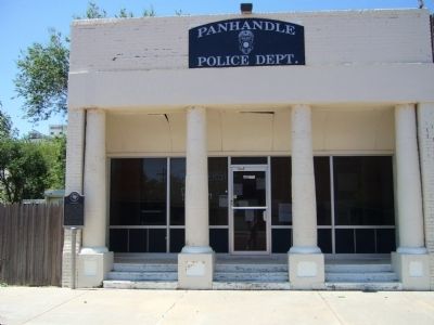
Location. 35° 20.543′ N, 101° 22.724′ W. Marker is in Panhandle, Texas, in Carson County. Marker is at the intersection of South Main Street and Broadway Street (Texas Highway 207), on the right when traveling south on South Main Street. Touch for map. Marker is at or near this postal address: 117 South Main Street, Panhandle TX 79068, United States of America. Touch for directions.
Other nearby markers. At least 8 other markers are within walking distance of this marker. Texan Hotel (about 300 feet away, measured in a direct line); Atchison, Topeka, & Santa Fe Railroad Depot (about 500 feet away); Atchison Topeka & Santa Fe Railway Depot (about 500 feet away); The John F. Weatherlys (about 600 feet away); Oldest Bank in the Texas Panhandle (about 600 feet away); Panhandle "Herald" (approx. 0.2 miles away); Callaghan Memorial Library (approx. 0.2 miles away); Old County Bookmobile (approx. 0.2 miles away). Touch for a list and map of all markers in Panhandle.
Credits. This page was last revised on June 16, 2016. It was originally submitted on June 1, 2012, by Bill Kirchner of Tucson, Arizona. This page has been viewed 467 times since then and 20 times this year. Photos: 1, 2. submitted on June 1, 2012, by Bill Kirchner of Tucson, Arizona. • Bernard Fisher was the editor who published this page.

