Panhandle in Carson County, Texas — The American South (West South Central)
Texas Panhandle Pioneers: The Simms Brothers
In the 1905-1906 winter, the Simms Brothers used mule-drawn plows and walked from Washburn (18 mi. SW) to Higgins (115.4 mi. NE), constructing a 4-furrow railway fireguard. John Sparks, an early local teacher and a Simms brother-in-law, worked with them and led the group in gospel singing at nightly campfires. Also in the crew were Jim Calhoun and John Sterling.
Family land ownership was preserved. Years later, oil and industry brought great prosperity to this region. A fourth generation now lives on the land.
Frank Simms married Minnie Pugh Williams; George married Alice Jane King; and Dormer married Gertrude Talbot. Descendants are leaders in Texas business.
Erected 1968 by State Historical Survey Committee. (Marker Number 4702.)
Topics. This historical marker is listed in this topic list: Settlements & Settlers. A significant historical year for this entry is 1886.
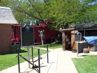
Location. 35° 20.767′ N, 101° 22.81′ W. Marker is in Panhandle, Texas, in Carson County. Marker can be reached from the intersection of Elsie Avenue (Route 207) and East 5th Street, on the right when traveling south. Marker is on the grounds of the Carson County Square House Museum. Touch for map. Marker is at or near this postal address: 503 Elsie Avenue, Panhandle TX 79068, United States of America. Touch for directions.
Other nearby markers. At least 8 other markers are within walking distance of this marker. Purvines Ranch Home (here, next to this marker); Pioneer Dugout (here, next to this marker); The Square House (a few steps from this marker); Eclipse Windmill Patented 1867 (a few steps from this marker); Temple Lea Houston (a few steps from this marker); Finch-Lord-Nelson and the Founding of Panhandle City (within shouting distance of this marker); Farm and Ranch Building (within shouting distance of this marker); Last Great Panhandle Cattle Drive to Montana (within shouting distance of this marker). Touch for a list and map of all markers in Panhandle.
Credits. This page was last revised on June 16, 2016. It was originally submitted on June 1, 2012, by Bill Kirchner of Tucson, Arizona. This page has been viewed 682 times since then and 20 times this year. Photos: 1, 2. submitted on June 1, 2012, by Bill Kirchner of Tucson, Arizona. • Bernard Fisher was the editor who published this page.

