McLean in Fairfax County, Virginia — The American South (Mid-Atlantic)
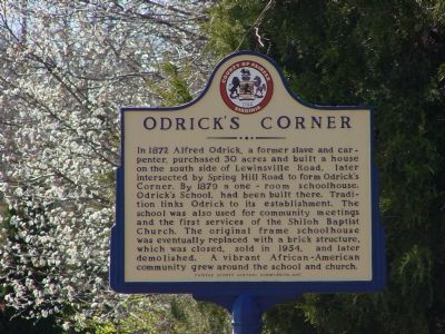
Odrick’s Corner
Erected 2001 by Fairfax County History Commission.
Topics and series. This historical marker is listed in these topic lists: African Americans • Churches & Religion • Education • Settlements & Settlers. In addition, it is included in the Virginia, Fairfax County History Commission series list. A significant historical year for this entry is 1872.
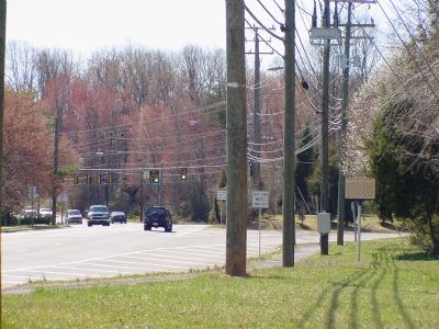
Location. 38° 56.384′ N, 77° 13.785′ W. Marker is in McLean, Virginia, in Fairfax County. Marker is at the intersection of Lewinsville Road (County Route 694) and Spring Hill Road (County Route 684), on the right when traveling west on Lewinsville Road. Park at the Spring Hill Recreation Center. Touch for map. Marker is in this post office area: Mc Lean VA 22101, United States of America. Touch for directions.
Other nearby markers. At least 8 other markers are within 2 miles of this marker, measured as the crow flies. First Court House of Fairfax County (approx. 1.7 miles away); A Union Spy of Color? (approx. 1.7 miles away); Family Strength (approx. 1.7 miles away); Freedom Hill is a Droplet in an Ocean of History (approx. 1.7 miles away); A Tent Design Inspired by Native Americans (approx. 1.7 miles away); Defending the Nation's Capital (approx. 1.7 miles away); Outpost Life (approx. 1.7 miles away); Old Georgetown Pike Ancient Indian Trail (approx. 1.8 miles away).
Also see . . . Odrick's Corner Located with Historic Marker. Newspaper Article with background information on Alfred Odrick and Odrick's Corner. (Submitted on March 18, 2006.)
Credits. This page was last revised on July 14, 2019. It was originally submitted on March 18, 2006, by J. J. Prats of Powell, Ohio. This page has been viewed 3,519 times since then and 74 times this year. Last updated on February 22, 2008, by Christopher Busta-Peck of Shaker Heights, Ohio. Photos: 1, 2. submitted on March 18, 2006, by J. J. Prats of Powell, Ohio. • Kevin W. was the editor who published this page.

