El Dorado in Butler County, Kansas — The American Midwest (Upper Plains)
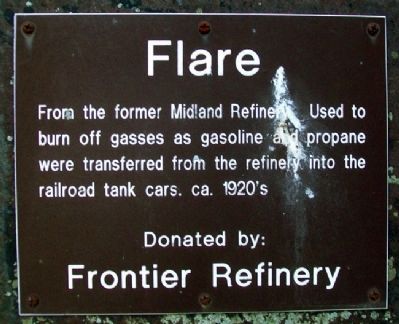
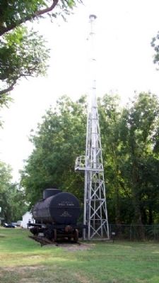
Flare
From the former Midland Refinery. Used to burn off gasses as gasoline and propane were transferred from the refinery into the railroad tank cars. ca. 1920's
Donated by: Frontier Refinery
Erected by Kansas Oil Museum.
Topics. This historical marker is listed in this topic list: Industry & Commerce.
Location. 37° 48.971′ N, 96° 50.688′ W. Marker is in El Dorado, Kansas, in Butler County. Marker is in the fenced outdoor Kansas Oil Museum exhibit area of the Butler County History Center. Touch for map. Marker is at or near this postal address: 383 East Central Avenue (US 54), El Dorado KS 67042, United States of America. Touch for directions.
Other nearby markers. At least 8 other markers are within walking distance of this marker. Union Tank Car (a few steps from this marker); Oil Field Boom Towns (within shouting distance of this marker); Grandma Anderson's House (within shouting distance of this marker); Kansas Oil Museum (within shouting distance of this marker); Cable Tool Drilling Rig (within shouting distance of this marker); Mrs. Addie Cowley Bradley (within shouting distance of this marker); Steel Oil Derrick / 1930's Cable-Tool Drilling Rig (within shouting distance of this marker); Tool Rack (within shouting distance of this marker). Touch for a list and map of all markers in El Dorado.
Also see . . . Butler County History Centery and Kansas Oil Museum. (Submitted on June 8, 2012, by William Fischer, Jr. of Scranton, Pennsylvania.)
Credits. This page was last revised on August 31, 2020. It was originally submitted on June 8, 2012, by William Fischer, Jr. of Scranton, Pennsylvania. This page has been viewed 478 times since then and 6 times this year. Photos: 1, 2. submitted on June 8, 2012, by William Fischer, Jr. of Scranton, Pennsylvania.

