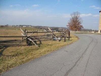
Near Sharpsburg in Washington County, Maryland — The American Northeast (Mid-Atlantic)
D.H. Hill's Division, Jackson's Command
D.H. Hill's Division, Jackson's Command.
Major General D.H. Hill, Commanding.
(September 15-16, 1862.)
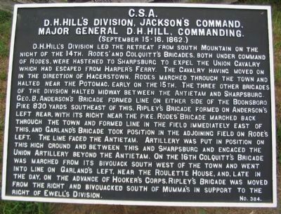
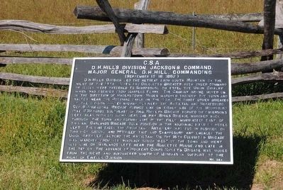
D.H. Hill's Division led the retreat from South Mountain on the night of the 14th. Rodes' and Colquitt's Brigades, both under command of Rodes, were hastened to Sharpsburg to expel the Union cavalry which had escaped from Harper's Ferry. The cavalry having moved on the direction of Hagerstown, Rodes marched through the town and halted near the Potomac, early on the 15th. The three other brigades of the division halted midway between the Antietam and Sharpsburg. Geo. B. Anderson's Brigade formed line on either side of the Boonsboro Pike 830 yards southeast of this. Rodes' Brigade formed on Anderson's left rear, with its right near the pike. Rodes' Brigade marched back through the town and formed line in the field immediately east of this, and Garland's Brigade took position in the adjoining field on Rodes' left. The line faced the Antietam. Artillery was put in position on this high ground and between this and Sharpsburg and engaged the Union Artillery beyond the Antietam. On the 16th Colquitt's Brigade was marched from its bivouack south west of the town and went into line on Garland's left, near the Roulette House, and late in the day, on the advance of Hooker's Corps, Ripley's Brigade was moved from the right and bivouacked south of Mumma's in support to the right of Ewell's Division.
Erected by Antietam Battlefield Board. (Marker Number 384.)
Topics and series. This historical marker is listed in this topic list: War, US Civil. In addition, it is included in the Antietam Campaign War Department Markers series list. A significant historical year for this entry is 1862.
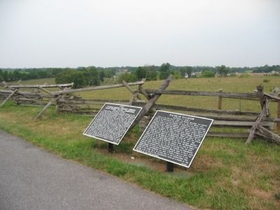
Location. 39° 28.126′ N, 77° 44.185′ W. Marker is near Sharpsburg, Maryland, in Washington County. Marker is on Richardson Avenue, on the right when traveling south. One of two markers located just past the Observation Tower, stop eight, on the driving tour of Antietam Battlefield. Touch for map. Marker is in this post office area: Sharpsburg MD 21782, United States of America. Touch for directions.
Other nearby markers. At least 8 other markers are within walking distance of this marker. A different marker also named D.H. Hill's Division (here, next to this marker); War Department Observation Tower (within shouting distance of this marker); Irish Brigade (within shouting distance of this marker); Major General Israel B. Richardson (within shouting distance of this marker); Hexamer's (New Jersey) Battery (within shouting distance of this marker); Army of Northern Virginia (about 300 feet away, measured in a direct line); a different marker also named Army of Northern Virginia (about 300 feet away); September 17, 1862 (Continued) (about 300 feet away). Touch for a list and map of all markers in Sharpsburg.
Regarding D.H. Hill's Division, Jackson's Command. This marker is included on the Sunken Road or Bloody Lane Virtual Tour by Markers see the Virtual tour link below to see the markers in sequence.
Furthermore, all markers and monuments for D.H. Hill's Division are grouped under the Related Markers section below.
Related markers. Click here for a list of markers that are related to this marker. Markers and Monuments for D.H. Hill's Division
Also see . . .
1. Antietam Battlefield. National Park Service site. (Submitted on February 22, 2008, by Craig Swain of Leesburg, Virginia.)
2. D.H. Hill's Division. Charged under the famous Special Orders 191 to guard the mountain passes, the division was heavily engaged at South Mountain days before the battle of Antietam. (Submitted on February 22, 2008, by Craig Swain of Leesburg, Virginia.)

Photographed By Craig Swain
6. D.H. Hill's Division Defends the Sunken Road Sector
Much of the fighting of D.H. Hill's men took place within this view from the observation tower at the Sunken Road Tour Stop. This view looks over the Piper Farm, the Sunken Road and the fields where the Federals charged against the Confederate position.
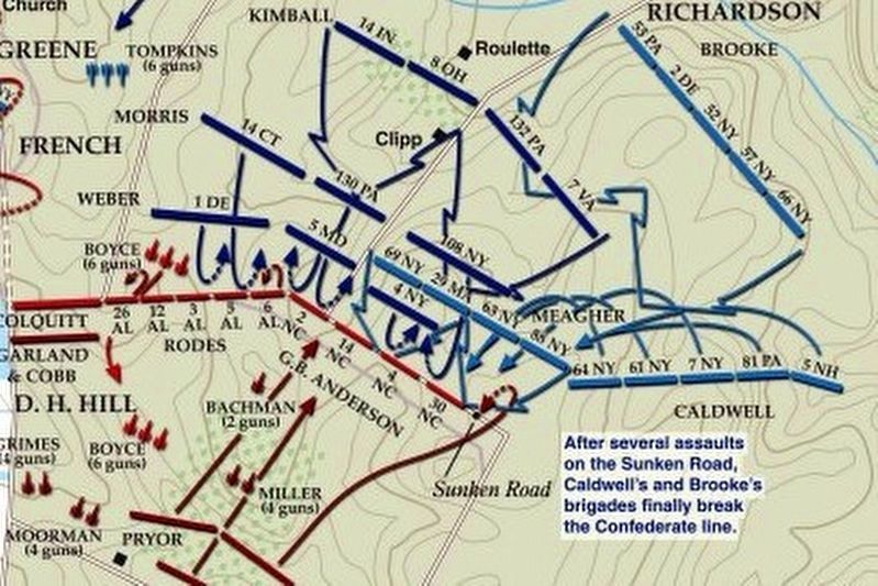
via American Battlefield Trust, unknown
7. Sunken Road or Bloody Lane Virtual Tour by Markers.
A collection of markers interpreting the action of during the Battle of Antietam around the Sunken Road.
(Submitted on February 23, 2008, by Craig Swain of Leesburg, Virginia.)
Click for more information.
(Submitted on February 23, 2008, by Craig Swain of Leesburg, Virginia.)
Click for more information.
Credits. This page was last revised on April 3, 2022. It was originally submitted on February 22, 2008, by Craig Swain of Leesburg, Virginia. This page has been viewed 1,175 times since then and 17 times this year. Photos: 1. submitted on February 22, 2008, by Craig Swain of Leesburg, Virginia. 2. submitted on September 30, 2015, by Brian Scott of Anderson, South Carolina. 3. submitted on February 22, 2008, by Craig Swain of Leesburg, Virginia. 4. submitted on September 30, 2015, by Brian Scott of Anderson, South Carolina. 5. submitted on February 23, 2008, by Craig Swain of Leesburg, Virginia. 6. submitted on December 5, 2008, by Craig Swain of Leesburg, Virginia. 7. submitted on April 3, 2022, by Larry Gertner of New York, New York.
