Eastport in Anne Arundel County, Maryland — The American Northeast (Mid-Atlantic)
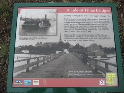
A Tale of Three Bridges
The first wooden bridge, built in 1868, connected here at the end of Fourth Street. It served pedestrians and horse-drawn wagons. Forty years later, a larger steel bridge was built in the same location for cars and trucks. The bridge tender lived on the bridge and opened the pivoting central span by hand-crank whenever a boat needed to pass through. On hot days, the steel expanded, preventing the span from closing properly until a fire truck was called to hose it down with cold water.
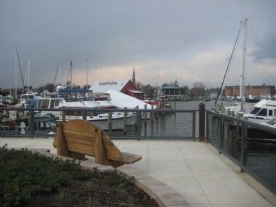
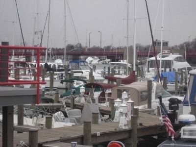
The drawbridge you see today, connecting with Sixth Street two blocks to your left, was built in 1947 with heavy weights to counter-balance the center spans. If you hear a horn, watch how the bridge opens to let a sailboat through.
Text with upper left photo: Before bridges were built, Eastporters traveled to and from Annapolis by ferry to avoid the three-mile detour around the end of Spa Creek.
Erected by Chesapeake Bay Gateways Network, Annapolis Maritime Museum, Four Rivers Garden Club.
Topics. This historical marker is listed in these topic lists: Bridges & Viaducts • Roads & Vehicles. A significant historical year for this entry is 1868.
Location. 38° 58.325′ N, 76° 28.985′ W. Marker is in Eastport, Maryland, in Anne Arundel County. Marker is on Fourth Street, 0 miles north of Severn Avenue when traveling north. Marker is at the end of Fourth Street. Touch for map. Marker is in this post office area: Annapolis MD 21403, United States of America. Touch for directions.
Other nearby markers. At least 8 other markers are within walking distance of this marker. Eastport's Old "Main Street" (here, next to this marker); Arnold C. Gay (here, next to this marker); Three Great Boat Yards, One Location (about 600 feet away, measured in a direct line); On to Yorktown (about 600 feet away); Welcome to Eastport (about 600 feet away); Lafayette’s Encampment (about 700 feet away); Eastport Veterans Park (about 700 feet away); The Glass Works (approx. 0.2 miles away). Touch for a list and map of all markers in Eastport.
Credits. This page was last revised on March 27, 2018. It was originally submitted on February 23, 2008, by F. Robby of Baltimore, Maryland. This page has been viewed 1,761 times since then and 45 times this year. Last updated on March 11, 2018, by Devry Becker Jones of Washington, District of Columbia. Photos: 1, 2, 3. submitted on February 23, 2008, by F. Robby of Baltimore, Maryland. • Bill Pfingsten was the editor who published this page.


