Near Quincy in Plumas County, California — The American West (Pacific Coastal)
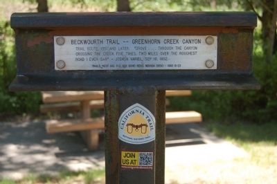
Beckwourth Trail – Greenhorn Creek Canyon
Erected 1993 by Trails West Inc. (Marker Number B-23.)
Topics and series. This historical marker is listed in this topic list: Roads & Vehicles. In addition, it is included in the California Trail, and the Trails West Inc. series lists. A significant historical date for this entry is September 16, 1904.
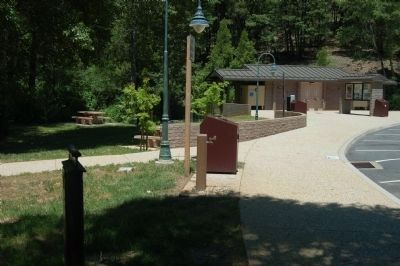
Location. 39° 54.989′ N, 120° 49.558′ W. Marker is near Quincy, California, in Plumas County. Marker can be reached from California Route 70 at milepost 49.5. The marker is located at the Massack Rest Area. Touch for map. Marker is at or near this postal address: 49780 Highway 70, Quincy CA 95971, United States of America. Touch for directions.
Other nearby markers. At least 8 other markers are within 7 miles of this marker, measured as the crow flies. Spring Garden (approx. 2.6 miles away); Mt. Ingalls Lookout (approx. 5 miles away); Plumas County’s First School House (approx. 5 miles away); Beckwourth Trail – New England Ranch (approx. 5.2 miles away); Sloat Towne Hall (approx. 6.3 miles away); Oakland Camp (approx. 6.4 miles away); Sloat Mill Site (approx. 6.4 miles away); The Clough/Braden Home (approx. 6˝ miles away). Touch for a list and map of all markers in Quincy.
Click on the ad for more information.
Please report objectionable advertising to the Editor.
sectionhead>More about this marker. Trails West Inc. have placed over 50 markers on the Beckwourth Trail between Sparks, Nevada and Lake Oroville, California, 31 of which are located in Plumas County. They have also placed over 400 markers on the California, Applegate, Lassen and Nobles' Emigrant Trails.Please report objectionable advertising to the Editor.
Also see . . . The Beckwourth Trail - beckwourth.org. James Beckwourth discovered what is now known as Beckwourth Pass in the spring of 1850, and immediately set about establishing a trail to Marysville. He worked on the trail in the summer and fall of 1850 and the spring of 1851, and in the late summer of that year led the first wagon train of settlers along the trail into Marysville. (Submitted on June 17, 2012, by Barry Swackhamer of Brentwood, California.)
Credits. This page was last revised on June 16, 2016. It was originally submitted on June 17, 2012, by Barry Swackhamer of Brentwood, California. This page has been viewed 506 times since then and 23 times this year. Photos: 1, 2. submitted on June 17, 2012, by Barry Swackhamer of Brentwood, California. • Syd Whittle was the editor who published this page.

