Near Cromberg in Plumas County, California — The American West (Pacific Coastal)
Sloat Mill Site
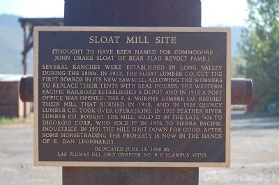
Several ranches were established in Long Valley during the 1800s. In 1912, the Sloat Lumber Co. cut the first boards in its new sawmill, allowing the workers to replace their tents with real houses. The Western Pacific Railroad established a depot and in 1915 a post office was opened. The F.S. Murphy Lumber Co. rebuilt their mill that burned in 1918, and in 1926 Quincy Lumber Co. took over operations. In 1955 Feather River Lumber Co. bought the mill, sold it in the late ‘60s to Digorgio Corp., who sold it in 1976 to Sierra Pacific Industries. In 1991 the mill shut down for good. After some horsetrading the property is now in the hands of E. Dan Leonhardt.
Erected 1998 by E Clampus Vitus, Las Plumas del Oro Chapter No. 8.
Topics and series. This historical marker is listed in this topic list: Industry & Commerce. In addition, it is included in the E Clampus Vitus series list. A significant historical year for this entry is 1912.
Location. 39° 51.779′ N, 120° 43.647′ W. Marker is near Cromberg, California, in Plumas County. Marker is at the intersection of Sloat Road and Poplar Valley Road, on the right when traveling south on Sloat Road. Touch for map . Marker is at or near this postal address: 1231 Sloat Road, Blairsden-Graeagle CA 96103, United States of America. Touch for directions.
Other nearby markers. At least 8 other markers are within 8 miles of this marker, measured as the crow flies. Sloat Towne Hall (approx. ¼ mile away); Twenty Mile House (approx. 1.9 miles away); Jackson, Ross, Tefft and Dempsey Memorial (approx. 2.4 miles away); Vardanega Spring (approx. 2½ miles away); Spring Garden (approx. 3.8 miles away); Beckwourth Trail – Greenhorn Creek Canyon (approx. 6.4 miles away); Longboard Ski Races (approx. 6.8 miles away); Jamison City, Eureka Mine and Mill, Johnstown (approx. 7.1 miles away). Touch for a list and map of all markers in Cromberg.
Credits. This page was last revised on June 16, 2016. It was originally submitted on June 19, 2012, by Barry Swackhamer of Brentwood, California. This page has been viewed 586 times since then and 28 times this year. Photos: 1, 2. submitted on June 19, 2012, by Barry Swackhamer of Brentwood, California. • Syd Whittle was the editor who published this page.

