Near Sharpsburg in Washington County, Maryland — The American Northeast (Mid-Atlantic)
Longstreet's Command
Wofford's Brigade, Hood's Division
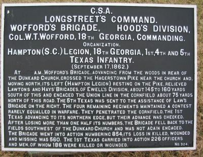
Longstreet's Command.
Wofford's Brigade, Hood's Division,
Col. W.T. Wofford, 18th Georgia, Commanding.
Organization.
Hampton (S.C.) Legion, 18th Georgia, 1st, 4th, and 5th
Texas Infantry.
(September 17, 1862.)
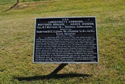
At [erased]a.m., Wofford's Brigade, advancing from the woods in rear of the Dunkard Church, crossed the Hagerstown Pike near the church and, moving north, its left (Hampton Legion) resting on the Pike, were relieved south of this and engaged the Union line in the cornfield about 75 yards north of this road. The 5th Texas was sent to the assistance of Law's Brigade on the right. The four remaining regiments maintained a contest rarely equalled in warfare. They penetrated the cornfield, the 1st Texas advancing to its northern edge, but their advance was checked. After losing more than one half its numbers, the Brigade fell back to the fields southwest of the Dunkard Church and was not again engaged. The Brigade went into action numbering 854; its loss in killed, wounded and missing was 560. The 1st Texas carried into action 226 officers and men, of whom 186 were killed or wounded.
Erected by Antietam Battlefield Board. (Marker Number 324.)
Topics and series. This historical marker is listed in this topic list: War, US Civil . In addition, it is included in the Antietam Campaign War Department Markers series list. A significant historical date for this entry is September 17, 1862.
Location. 39° 28.852′ N, 77° 44.798′ W. Marker is near Sharpsburg, Maryland, in Washington County. Marker is on Cornfield Avenue, on the right when traveling east. Located near stop four of the driving tour of Antietam Battlefield and stop six of the Cornfield walking trail. Touch for map. Marker is in this post office area: Sharpsburg MD 21782, United States of America. Touch for directions.
Other nearby markers. At least 10 other markers are within walking distance of this marker. Jackson's Command (a few steps from this marker); 84th New York (14th Brooklyn) Volunteer Infantry (within shouting distance of this marker); Texas (within shouting distance of this marker); First Army Corps (within shouting distance of this marker); Hood's Division, Longstreet's Command (within shouting distance of this marker); a different marker also named Longstreet's Command (within shouting distance of this marker); a different marker also named Hood's Division, Longstreet's Command (within shouting distance of this marker); Georgia Confederate Soldiers (within shouting distance of this marker); a different marker also named Jackson's Command (about 300 feet away, measured in a direct line); "Every Stalk of Corn" (about 300 feet away). Touch for a list and map of all markers in Sharpsburg.
More about this marker. The original time cited on the opening line of the text was 7 a.m.
Related markers. Click here for a list of markers that are related to this marker. Wofford's or Hood's Texas Brigade Markers and Monuments
Also see . . .
1. Antietam Battlefield. National Park Service site. (Submitted on February 23, 2008, by Craig Swain of Leesburg, Virginia.)
2. Hood's Brigade. Know for its previous commander, General John B. Hood, who had been promoted to division command, the Brigade is one of the most famous in history. (Submitted on February 23, 2008, by Craig Swain of Leesburg, Virginia.)
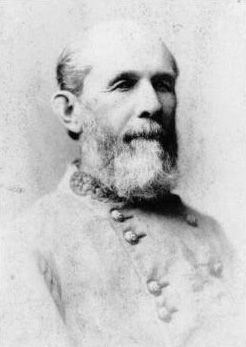
3. William T. Wofford. William Tatum Wofford (June 28, 1824 – May 22, 1884) was an officer during the Mexican-American War and a general in the Confederate States Army during the American Civil War. (Submitted on October 21, 2015, by Brian Scott of Anderson, South Carolina.)
Photographed By Craig Swain, February 9, 2008
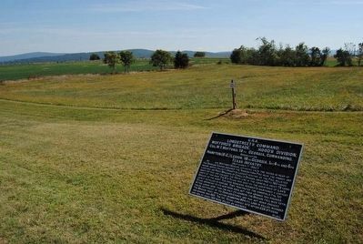
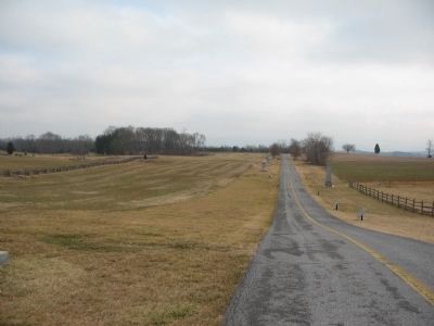
3. The Cornfield Avenue
The Cornfield Avenue is lined with monuments and war department tablets. The Wofford's Brigade tablet is the first in line on the right side of the road. This section of the battlefield was heavily contested. The road here is a modern addition. The boundary of the cornfield actually angled to the north (to the left of the photo) of the road. The 5th Texas, alone among the Brigade, was detached to the far right flank of Hood's Division. Their route passed down the Smoketown Road and into the East Woods to a point near the Mansfield Monument.
Photographed By Craig Swain, September 17, 2007
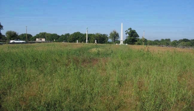
6. The Cornfield Today
Looking back toward the intersection of Cornfield Avenue and Dunker Church Road (Old Hagerstown Pike), the car on the left is parked in the pull off for tour stop four. The 1st Texas surged through from the left between that pull off and the camera's spot. They advance to the right of the view, nearly due north into the cornfield. The advance was atop a "plateau" running north to south through this sector of the battle area. As can be seen from the angle of the photograph, in only a few yards, the elevation rises and falls considerably.
Photographed By Craig Swain, February 9, 2008
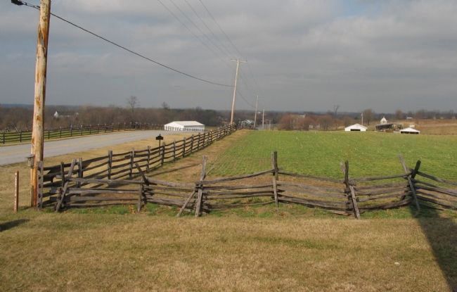
7. Texas Brigade's Line on the Hagerstown Pike
The Brigade, minus the 1st Texas that moved almost straight north and the 5th Texas detached to cover the far right flank, formed a battle line along the Hagerstown Pike. From this view, looking north from the Indiana State Monument, the right most and furthest north regiment was the 18th Georgia, occupying the fence line on the left of frame. The Hampton Legion stood in the center of the line, on the left of the photo where the fence is absent, with the 4th Texas as the Brigade's left holding just south of the intersection of the Cornfield road and the modern Dunker Church Road. The Georgians had a difficult time facing Battery B, 4th US Artillery which occupied the ground on the other side of the Pike. If one looks closely, two artillery pieces stand along the fence line on the Federal side of the road indicating the position of Battery B.
Credits. This page was last revised on October 25, 2017. It was originally submitted on February 23, 2008, by Craig Swain of Leesburg, Virginia. This page has been viewed 922 times since then and 18 times this year. Photos: 1. submitted on February 23, 2008, by Craig Swain of Leesburg, Virginia. 2. submitted on October 21, 2015, by Brian Scott of Anderson, South Carolina. 3. submitted on February 23, 2008, by Craig Swain of Leesburg, Virginia. 4, 5. submitted on October 21, 2015, by Brian Scott of Anderson, South Carolina. 6, 7. submitted on February 23, 2008, by Craig Swain of Leesburg, Virginia.
