Rossville in Atascosa County, Texas — The American South (West South Central)
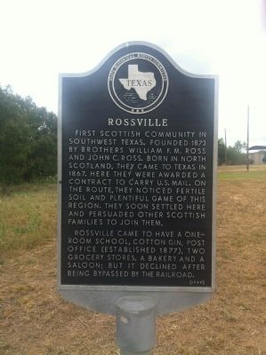
Rossville
Rossville came to have a one-room school, cotton gin, post office (established 1877), two grocery stores, a bakery and a saloon; but it declined after being bypassed by the railroad.
Erected 1969 by State Historical Survey Committee. (Marker Number 4355.)
Topics. This historical marker is listed in this topic list: Settlements & Settlers. A significant historical year for this entry is 1873.
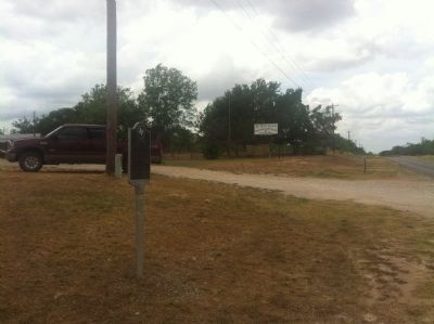
Location. 29° 5.1′ N, 98° 41.06′ W. Marker is in Rossville, Texas, in Atascosa County. Marker is on Farm to Market Road 2504, half a mile south of Route 476, on the left when traveling south. Touch for map. Marker is in this post office area: Poteet TX 78065, United States of America. Touch for directions.
Other nearby markers. At least 8 other markers are within 11 miles of this marker, measured as the crow flies. Rossville Cemetery (approx. 0.9 miles away); Anchorage Cemetery (approx. 1.9 miles away); Site of Jose Antonio Navarro Ranch Headquarters (approx. 3.4 miles away); Sand Branch Baptist Church (approx. 4˝ miles away); Amphion and Amphion Cemetery (approx. 6.7 miles away); Old Rock Baptist Church (approx. 7.3 miles away); Poteet (approx. 7.4 miles away); Kings Highway Camino Real — Old San Antonio Road (approx. 10.2 miles away). Touch for a list and map of all markers in Rossville.
Credits. This page was last revised on June 16, 2016. It was originally submitted on June 20, 2012, by John A Hensarling of Campbellton, Texas. This page has been viewed 780 times since then and 30 times this year. Photos: 1, 2. submitted on June 21, 2012, by John A Hensarling of Campbellton, Texas. • Bernard Fisher was the editor who published this page.

