Burlington Heights in Hamilton, Ontario — Central Canada (North America)
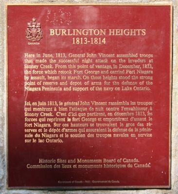
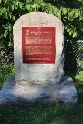
Burlington Heights 1813 - 1814
[English Text]:
Here in June, 1813, General John Vincent assembled troops that made the successful night attack on the invaders at Stoney Creek. From this point of vantage, in December, 1813, the force which retook Fort George and carried Fort Niagara by assault, began its march. On these heights stood the strong point of reserve and depot of arms for the defence of the Niagara Peninsula and support of the navy on Lake Ontario.
[French Text]:
Ici, en juin 1813, le general John Vincent rassembla les troupes qui menerent à bien l'attaque de nuit contre l'envahisseur à Stoney Creek. C'est d'ici que partirent, en decembre 1813, les forces qui reprirent le fort George et emporterent d'assaut le fort Niagara. Sur ces hauteurs se trouvaient le gros des reserves et le depot d'armes qui assuraient la defense de la peninsule du Niagara et le soutien des troupes navales en service sur le lac Ontario.
Erected by Historic Sites and Monuments Board of Canada.
Topics and series. This historical marker is listed in these topic lists: Forts and Castles • War of 1812. In addition, it is included in the Canada, Historic Sites and Monuments Board series list. A significant historical month for this entry is June 1813.
Location. 43° 16.319′ N, 79° 53.154′ W. Marker is in Burlington Heights, Ontario, in Hamilton. Marker is on York Boulevard just north of Dundurn Street North, on the right when traveling north. The historic marker is located in Harvey Park, next to Dundurn Castle, on the Burlington Heights of Hamilton. Touch for map. Marker is at or near this postal address: 610 York Blvd, Burlington Heights ON L8R L8R, Canada. Touch for directions.
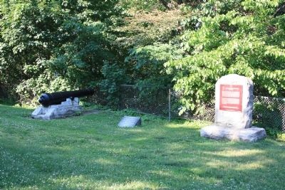
Other nearby markers. At least 8 other markers are within walking distance of this marker. First Line of Defense (here, next to this marker); March to Stoney Creek (about 180 meters away, measured in a direct line); "The Burlington Races" 1813 (about 180 meters away); Defensive Outwork (about 240 meters away); United Empire Loyalists (about 240 meters away); Sir John Harvey (approx. 0.2 kilometers away); Dundurn Castle (approx. 0.3 kilometers away); Sir Allan Napier MacNab (approx. 0.3 kilometers away). Touch for a list and map of all markers in Burlington Heights.
Also see . . . Burlington Heights National Historic Site of Canada. Parks Canada entry (Submitted on June 24, 2012, by Dale K. Benington of Toledo, Ohio.)
Credits. This page was last revised on April 29, 2023. It was originally submitted on June 24, 2012, by Dale K. Benington of Toledo, Ohio. This page has been viewed 836 times since then and 27 times this year. Photos: 1, 2, 3. submitted on June 24, 2012, by Dale K. Benington of Toledo, Ohio.


