South Mills in Camden County, North Carolina — The American South (South Atlantic)
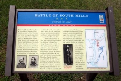
Battle of South Mills
Fight for the Canal
— Burnside Expedition —
Early in 1862, Union Gen. Ambrose E. Burnside led an expedition to secure the coast of North Carolina and occupy strategically important sites such as New Bern and Elizabeth City. After Burnside learned of the March 9 clash between USS Monitor and CSS Virginia (formerly Merrimack) in Hampton Roads, Virginia, he became concerned that Confederate ironclads might attack his right flank from Virginia via the Dismal Swamp Canal. He decided to destroy these locks and close the canal here. Burnside assigned Gen. Jesse L. Reno the task, and before dawn on April 19, Reno led a four-gun battery and more than 3,000 men north from Elizabeth City.
Three miles southeast of here, Reno encountered Confederate Col. Ambrose R. Wright’s 3rd Georgia Regiment and North Carolina militiamen (about 750 altogether) in a ditch behind a fence, obscured by burning brush in another ditch in front. A Confederate battery commanded the road. After several hours of skirmishing, Union Col. Rush C. Hawkins ordered his 9th New York Zouaves to charge the battery, but strong Confederate fire drove them back with heavy casualties. After more fighting, Wright withdrew to Joy’s Creek to await reinforcements and more ammunition. The Federals bivouacked on the field but marched back to Elizabeth City during the night when rumors of a counterattack reached Reno. The canal remained intact, the Confederates lost only 28 killed and wounded, and the Federals suffered 127 casualties. Reno’s claims to the contrary, South Mills was clearly a Southern victory, but no Confederate ironclads ever used the canal and no serious threat was ever mounted to Burnside’s flank from this direction.
Erected by North Carolina Civil War Trails.
Topics and series. This historical marker is listed in this topic list: War, US Civil. In addition, it is included in the North Carolina Civil War Trails series list. A significant historical month for this entry is March 1812.
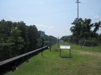
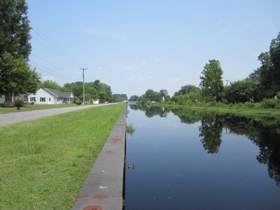
Location. 36° 26.492′ N, 76° 19.518′ W. Marker is in South Mills, North Carolina, in Camden County. Marker is on Canal Drive, 0.3 miles south of Main Street (U.S. 17), on the left when traveling south. Touch for map. Marker is at or near this postal address: 130 Joy's Creek Rd, South Mills NC 27976, United States of America. Touch for directions.
Other nearby markers. At least 8 other markers are within 11 miles of this marker, measured as the crow flies. Dismal Swamp Canal (approx. 0.4 miles away); McBride Church (approx. 0.4 miles away); McBride Colored School (approx. 0.6 miles away); a different marker also named Battle of South Mills (approx. 2.3 miles away); Eastern North Carolina (approx. 4.8 miles away); a different marker also named Dismal Swamp Canal (approx. 4.8 miles away); Seven Patriot Heroes (approx. 9.9 miles away in Virginia); Former Site of Sawyer's Creek / Marian Anderson High School (approx. 10.1 miles away). Touch for a list and map of all markers in South Mills.
More about this marker. On the lower left are portraits of "Gen. Ambrose Burnside" and "Gen. Jesse Reno"
In the center is a photograph with the caption, "Col. Rush C. Hawkins, clad in the Zouaves’ colorful uniform."
On the right is a map of the "South Mills engagement on Dismal Swamp Canal"
Credits. This page was last revised on November 3, 2021. It was originally submitted on June 25, 2012, by Bernard Fisher of Richmond, Virginia. This page has been viewed 1,155 times since then and 55 times this year. Photos: 1, 2, 3. submitted on June 25, 2012, by Bernard Fisher of Richmond, Virginia.


