Elizabeth City in Pasquotank County, North Carolina — The American South (South Atlantic)
A Town Divided
The Burning of Elizabeth City
During the Civil War, neither the North nor the South was totally united over the key issues. Just as some Northerners supported slavery and secession, some Southerners were abolitionist and Unionists. These issues could split families, divide communities, and generate violence. As the “official” war progressed, quasi-military organization were formed to wage another war against soldiers and civilians alike. Ambushes and retaliation comprised the “war within the war” between 1861 and 1865.
(main text)
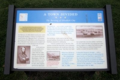
On February 10, 1862, Federal naval power under Commander Stephen C. Rowan overwhelmed the small flotilla (the “Mosquito Fleet”) of Confederate gunboats off Cobb’s Point on the Pasquotank River. Elizabeth City would soon be occupied and would remain in Union hands for the remainder of the war.
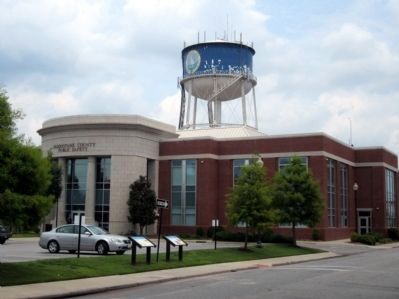
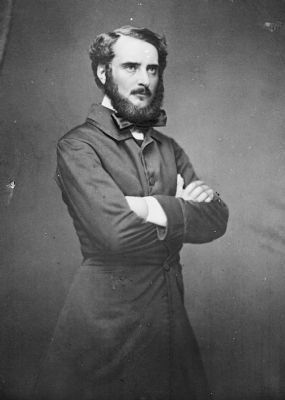
Local secessionists who preferred to see the town burn rather than be under Federal control asked Col. Charles Frederick Henningsen, 59th Virginia Infantry, to set it afire as he evacuated his force. He complied, and the fire destroyed the courthouse, which stood on the site of the present building. Fortunately, the county records had been removed for safekeeping.
Unionist residents put out the fires. The incident revealed the deep rifts in the community between secessionists who would burn their own homes to show their enemy “that they were fighting a people they can never subdue” and Unionists who would risk their lives among their secessionist neighbors to support the Federal occupation. What began as a political disagreement quickly escalated into guerilla warfare.
“The Federals…are in their vessels near E. City. The town has been fired…and a considerable portion burned. It is expected that the remaining portion will be burned.” —Richard B. Creecy to daughter Betty, Feb. 13, 1862
“About two-thirds of the town is burned. …The inhabitants have all left and burned the town themselves.” —Gen. Henry A. Wise Feb. 11, 1862
“I detached Sergeant Scroggs…with a detail, to aid the citizens in destroying the place by fire, as I had been requested to do by some of the most prominent of them. They only partially succeeded, two blocks only having been burned and a few isolated houses in the suburbs." —Col. Charles K. Henningsen, Feb. 12, 1862
(captions)
Col. Charles F. Henningsen Courtesy Library of Congress
The engraving of the burning of Hampton, Va., shows what Elizabeth City may have looked like as it burned. Harper’s Weekly, Aug. 31, 1861
Elizabeth City", Harper’s Weekly, March 15, 1862
Major funding for this project was provided by the North Carolina Department of Transportation, through the Transportation Enhancement Program of the Federal Transportation Efficiency Act for the 21st Century
Erected by North Carolina Civil War Trails.
Topics and series. This historical marker is listed in this topic list: War, US Civil. In addition, it is included in the North Carolina Civil War Trails series list. A significant historical date for this entry is February 10, 1862.
Location. 36° 18.055′ N, 76° 13.371′ W. Marker is in Elizabeth City, North Carolina, in Pasquotank County. Marker is at the intersection of East Colonial Avenue and North Elliot Street, on the left when traveling east on East Colonial Avenue. Touch for map. Marker is in this post office area: Elizabeth City NC 27909, United States of America. Touch for directions.
Other nearby markers. At least 8 other markers are within walking distance of this marker. A different marker also named A Town Divided (here, next to this marker); W. O. Saunders (within shouting distance of this marker); Pasquotank County Courthouse 1882 (within shouting distance of this marker); World Wars I and II Memorial (within shouting distance of this marker); Historic Events in Pasquotank (within shouting distance of this marker); Veterans Memorial (within shouting distance of this marker); Elizabeth City Confederate Monument (about 300 feet away, measured in a direct line); a different marker also named A Town Divided (about 300 feet away). Touch for a list and map of all markers in Elizabeth City.
Credits. This page was last revised on September 1, 2021. It was originally submitted on June 25, 2012, by Bernard Fisher of Richmond, Virginia. This page has been viewed 661 times since then and 22 times this year. Photos: 1, 2, 3. submitted on June 25, 2012, by Bernard Fisher of Richmond, Virginia.


