Wilton in Saratoga County, New York — The American Northeast (Mid-Atlantic)
The Hotel and Ulysses S. Grant at Mt. McGregor
Inscription.
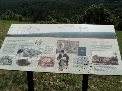
Mt. McGregor developed as a resort after a road and a small hotel (now Grant Cottage) were built by Duncan McGregor in the 1870s. A group of investors recognized the siteís potential and, in 1882, built a railroad line here from Saratoga Springs. Two years later, the luxurious Hotel Balmoral opened to guests advertising “No Dew, No Malaria, No Mosquitoes, Certain Relief from Hay Fever.” As many as seven trains a day traveled to and from the mountain. The Balmoral provided accommodations for Grantís friends and visitors, and for the reporters who kept a constant vigil on Grant. The hotel burned in 1897, and the railroad was dismantled in 1899.
In the summer of 1885 while trying to complete his memoirs, Ulysses S. Grant was dying of throat cancer. His doctors recommended Grant leave the heat and humidity of New York City. Joseph W. Drexel offered the Grants use of his cottage on Mt. McGregor. They accepted, arriving here on June 16. Engravings from Frank Leslieís Illustrated Newspaper, August 8, 1885.
Before arriving at Mt. McGregor, Grant had begun writing his memoirs. Grantís friend, Samuel Clements (Mark Twain) had agreed to publish the book through his firm, Charles L. Webster & Co. It was hoped that public demand for the book would insure financial security for Grantís wife Julia. Ulysses S. Grant, 18th president of the United States and Commanding General of the Union Army during the Civil War, died the morning of July 23, 1885, just days after completing his Personal Memoirs.
Preserving the Cottage and the Monument
After the hotel burned, the cottage and the outlook were preserved, first by the Grand Army of the Republic, and then by New York State. Today, the Friends of Ulysses S. Grant Cottage manage the site in cooperation with the New York State Office of Parks, Recreation and Historic Preservation and the New York State Department of Corrections.
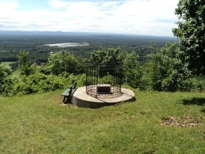
“The monument is built upon a concrete base and has a protective railing placed there by the Metropolitan Life Insurance Company to prevent visitors from taking chips off the monument which some years ago had to be recut because of that reason.” Excerpt from “The Passing of the Pine,” by J.F. OíNeill in the Mount McGregor Optimist, Jan, 1923.
Topics. This historical marker is listed in these topic lists: Industry & Commerce • Railroads & Streetcars. A significant historical month for this entry is June 1925.
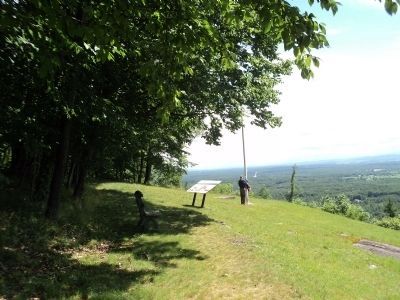
Location. 43° 12.054′ N, 73° 44.58′ W. Marker is in Wilton, New York, in Saratoga County. Marker can be reached from Mt. McGregor Road, on the right when traveling north. Marker is located at the overlook near the Visitor
Center at Grantís Cottage State Historic Site. The cottage is on the grounds of the Mt. McGregor Correctional Facility. Touch for map. Marker is in this post office area: Gansevoort NY 12831, United States of America. Touch for directions.
Other nearby markers. At least 8 other markers are within 2 miles of this marker, measured as the crow flies. Grantís Last Trip to the Eastern Outlook (within shouting distance of this marker); Grantís Last View of the Valley (within shouting distance of this marker); A Feat of Engineering (about 500 feet away, measured in a direct line); Ulysses S. Grant (about 600 feet away); Ulysses S. Grant Died (about 600 feet away); Grant Cottage (approx. half a mile away); a different marker also named Grant Cottage (approx. 1.4 miles away); a different marker also named Grant Cottage (approx. 1Ĺ miles away). Touch for a list and map of all markers in Wilton.
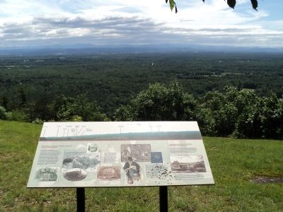
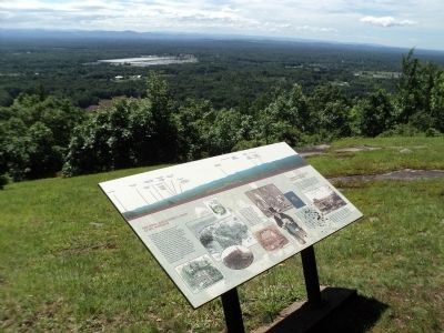
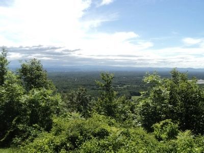
More about this marker. A photo of the view appears along the top of the marker. Identified in the photo are the locations of Glens Falls; Finch Pruyn & Co.; Glens Falls Cement; South Glens Falls Water Tower; Hudson Falls Adirondack Resource Recovery Facility; Southern end of the Champlain Valley; Exit 17 of the Northway; Fort Edward - Site of the Jane McCrea Massacre July 27, 1777; Hudson River Between Hills; Taconic Mountains; Green Mountains behind Taconic Range; Dorset Mountains, Taconic Range; and Equinox Mountains, Vermont Taconic Range elevation 3516 feet.
The marker also contains several photos and engravings of the Hotel Balmoral area, along with photos of Pres. Grant and his family at the cottage.
Also see . . .
1. Ulysses S. Grant. Wikipedia entry (Submitted on November 14, 2021, by Larry Gertner of New York, New York.)
2. Ulysses S. Grant Cottage National Historic Landmark. Website homepage (Submitted on June 29, 2012, by Bill Coughlin of Woodland Park, New Jersey.)
Credits. This page was last revised on November 14, 2021. It was originally submitted on June 29, 2012, by Bill Coughlin of Woodland Park, New Jersey. This page has been viewed 1,725 times since then and 69 times this year. Photos: 1, 2, 3, 4, 5, 6, 7. submitted on June 29, 2012, by Bill Coughlin of Woodland Park, New Jersey.
