Confederation Beach Park in Hamilton, Ontario — Central Canada (North America)
Hamilton - Scourge Project
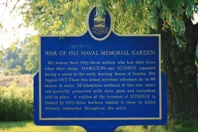
War of 1812 Naval Memorial Garden
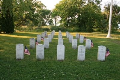
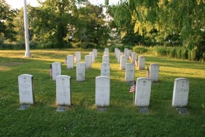
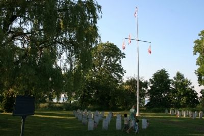
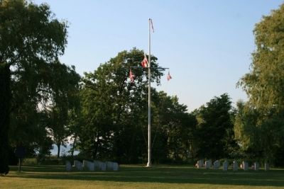
We honour here fifty-three sailors who lost their lives when their ships, HAMILTON and SCOURGE, capsized during a storm in the early morning hours of Sunday, 8th August 1813. These two armed merchant schooners lie in 90 metres of water, 30 kilometres northeast of this site, intact and perfectly preserved with their guns and equipment still in place. A replica of the foremast of SCOURGE is flanked by fifty-three markers similar to those in Allied military cemeteries throughout the world.
Topics. This historical marker is listed in these topic lists: War of 1812 • Waterways & Vessels. A significant historical year for this entry is 1813.
Location. 43° 14.91′ N, 79° 45.198′ W. Marker is in Hamilton, Ontario. It is in Confederation Beach Park. Marker can be reached from Confederation Drive east of Van Wagners Beach Road. The historic marker is located in Confederation Park, in the Edgewater Pavilion section of the park, near the Lake Ontario shoreline, close to an inland pond, very close to a replica foremast of a sailing vessel. Touch for map. Marker is in this post office area: Hamilton ON L8E L8E, Canada. Touch for directions.
Other nearby markers. At least 8 other markers are within 3 kilometers of this marker, measured as the crow flies. Hamilton & Scourge (a few steps from this marker); Discovery of Hamilton and Scourge (within shouting distance of this marker); The Shipwrecks of Confederation Park (approx. one kilometer away); Government House (King’s Head Inn) (approx. 1.6 kilometers away); The Hamilton Waterworks/ La Station de Pompage de Hamilton (approx. 1.8 kilometers away); Jimmy Howard (approx. 2.6 kilometers away); 'Mr. Hamilton' Reg Wheeler (approx. 2.8 kilometers away); Hamilton Aviation History (approx. 3 kilometers away). Touch for a list and map of all markers in Hamilton.
Also see . . .
1. The Hamilton & Scourge National Historic Site. This is a link to information provided by the City of Hamilton. (Submitted on July 1, 2012, by Dale K. Benington of Toledo, Ohio.)
2. USS Scourge (1812). This is a link to information provided by Wikipedia, the free encyclopedia. (Submitted on July 1, 2012, by Dale K. Benington of Toledo, Ohio.)
3. USS Hamilton (1809). This is a link to information provided by Wikipedia, the free encyclopedia. (Submitted on July 1, 2012, by Dale K. Benington of Toledo, Ohio.)
4. Hamilton and Scourge – 1982 Survey Expediton. This is a link to information provided by Wikipedia, the free encyclopedia. (Submitted on July 1, 2012, by Dale K. Benington of Toledo, Ohio.)
Photographed By Dale K. Benington, June 10, 2012
3. Hamilton - Scourge Project Marker
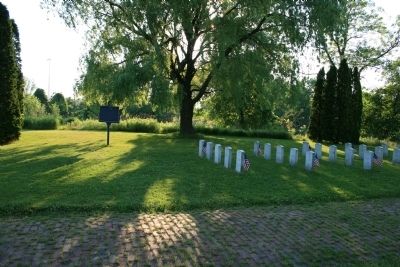
A distant view of the Memorial Garden and from left to right is seen first the historic marker, then the memorial stones for the crew of the Scourge, then a replica of ship's foremast, and then the memorial stones for the crew of the Hamilton.
Credits. This page was last revised on April 29, 2023. It was originally submitted on June 30, 2012, by Dale K. Benington of Toledo, Ohio. This page has been viewed 952 times since then and 28 times this year. Photos: 1, 2, 3, 4, 5, 6. submitted on July 1, 2012, by Dale K. Benington of Toledo, Ohio.
