Plymouth in Washington County, North Carolina — The American South (South Atlantic)
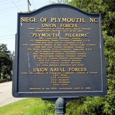
Siege of Plymouth, NC
Under the command of General Henry Walton Wessells
Engaged and captured April 17-20, 1864.
"Plymouth Pilgrims"
16th Connecticut Volunteer Infantry
2nd Massachusetts Heavy Artillery - Companies G & H
12th New York Cavalry - Companies A & F
24th Independent Battery B New York Veteran Light Artillery
85th New York Veteran Volunteer Infantry
2nd North Carolina Union Volunteers - Companies B & E
3d PA Heavy Artillery - Detachment Co. A
101st Pennsylvania Veteran Volunteer Infantry
103d Pennsylvania Veteran Volunteer Infantry
10th U.S. Colored Infantry - Detachment
37th U.S. Colored Infantry - Recruits
2nd U.S. Colored Cavalry - Recruits
U.S. Army gunboats Bombshell and Dolly
Union Naval Forces
Under the command of Lieutenant Commander Charles W. Flusser
U.S.S. Miami
U.S.S. Southfield
U.S.S. Massasoit
U.S.S. Whitehead
U.S.S. Ceres
Dedicated on the 135th Anniversary - April 17, 1999
Erected 1999.
Topics. This historical marker is listed in this topic list: War, US Civil. A significant historical date for this entry is April 17, 1733.
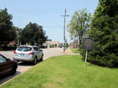
Location. 35° 52.104′ N, 76° 44.889′ W. Marker is in Plymouth , North Carolina, in Washington County. Marker is at the intersection of East Water Street and Madison Street, on the right when traveling west on East Water Street. Located in frontof the Port O’ Plymouth Roanoke River Museum. Touch for map. Marker is at or near this postal address: 302 E Water St, Plymouth NC 27962, United States of America. Touch for directions.
Other nearby markers. At least 8 other markers are within walking distance of this marker. Replica 6.4 inch Brooke Rifled Cannon (within shouting distance of this marker); Battle of Plymouth (within shouting distance of this marker); CSS Albemarle (within shouting distance of this marker); Rt. Rev. Alfred Augustin Watson (within shouting distance of this marker); a different marker also named CSS Albemarle (within shouting distance of this marker); Cushing’s Torpedo (about 500 feet away, measured in a direct line); Latham House (about 500 feet away); Washington County Courthouse (about 600 feet away). Touch for a list and map of all markers in Plymouth.
Credits. This page was last revised on June 16, 2016. It was originally submitted on July 1, 2012, by Bernard Fisher of Richmond, Virginia. This page has been viewed 776 times since then and 43 times this year. Photos: 1, 2. submitted on July 1, 2012, by Bernard Fisher of Richmond, Virginia.

