Roper in Washington County, North Carolina — The American South (South Atlantic)
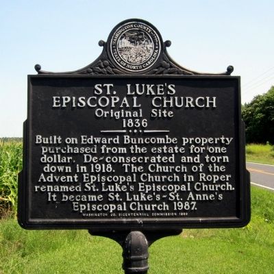
St. Luke's Episcopal Church
Original Site
— 1836 —
Erected 1999 by Washington Co. Bicentennial Commission.
Topics. This historical marker is listed in these topic lists: Cemeteries & Burial Sites • Churches & Religion. A significant historical year for this entry is 1918.
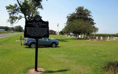
Location. 35° 53.841′ N, 76° 37.598′ W. Marker is in Roper, North Carolina, in Washington County. Marker is on Cross Road, half a mile north of Woodlawn Road, on the right when traveling south. Touch for map. Marker is in this post office area: Roper NC 27970, United States of America. Touch for directions.
Other nearby markers. At least 8 other markers are within 7 miles of this marker, measured as the crow flies. Edward Buncombe (approx. 1.6 miles away); Sleepy Hollow (approx. 1.6 miles away); Mackeys Ferry (approx. 2.8 miles away); Battle of Plymouth (approx. 6 miles away); Rehoboth Church (approx. 6˝ miles away); Naval Action (approx. 6.6 miles away); Fort Compher Battlefield (approx. 6.8 miles away); Battle of Plymouth Memorial (approx. 6.8 miles away). Touch for a list and map of all markers in Roper.
Credits. This page was last revised on June 16, 2016. It was originally submitted on July 2, 2012, by Bernard Fisher of Richmond, Virginia. This page has been viewed 455 times since then and 17 times this year. Photos: 1, 2. submitted on July 2, 2012, by Bernard Fisher of Richmond, Virginia.

