Marker Logo HMdb.org THE HISTORICAL
MARKER DATABASE
“Bite-Size Bits of Local, National, and Global History”
Black Rock in Buffalo in Erie County, New York — The American Northeast (Mid-Atlantic)
 

Burning of Blackrock and Buffalo

War of 1812


Burning of Blackrock and Buffalo Marker image. Click for full size.
Photographed By Dale K. Benington, June 10, 2012
1. Burning of Blackrock and Buffalo Marker
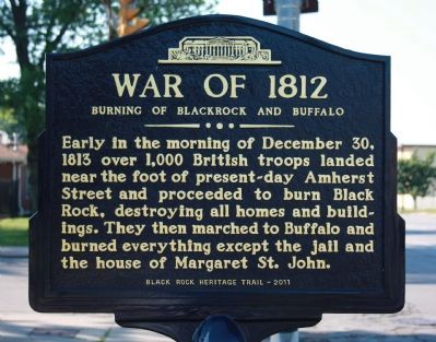
Inscription. Early in the morning of December 30, 1813 over 1,000 British troops landed near the foot of present-day Amherst Street and proceeded to burn Black Rock, destroying all homes and buildings. They then marched to Buffalo and burned everything except the jail and the house of Margaret St. John.
 
Erected 2011 by Black Rock Heritage Trail.
 
Topics. This historical marker is listed in these topic lists: Settlements & SettlersWar of 1812. A significant historical date for this entry is December 30, 1938.
 
Location. 42° 56.083′ N, 78° 54.129′ W. Marker is in Buffalo, New York, in Erie County. It is in Black Rock. Marker is at the intersection of Niagara Street and Amherst Street, on the right when traveling north on Niagara Street. Touch for map. Marker is in this post office area: Buffalo NY 14207, United States of America. Touch for directions.
 
Other nearby markers. At least 8 other markers are within walking distance of this marker. Black Rock (within shouting distance of this marker); Market Square (within shouting distance of this marker); Black Rock Harbor (within shouting distance of this marker); a different marker also named Market Square (within shouting distance of this marker); Stephen W. Howell (about 300 feet away, measured in a direct line); Jacob Smith House and Tavern
Paid Advertisement
Click on the ad for more information.
Please report objectionable advertising to the Editor.
Click or scan to see
this page online
(about 500 feet away); Buffalo and Niagara Falls Railroad (about 600 feet away); St. John's Church (about 700 feet away). Touch for a list and map of all markers in Buffalo.
 
Burning of Blackrock and Buffalo Marker image. Click for full size.
Photographed By Dale K. Benington, June 10, 2012
2. Burning of Blackrock and Buffalo Marker
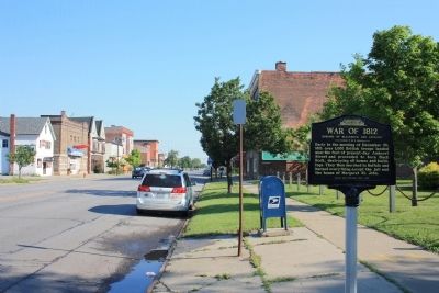
View of the historic marker looking north along Niagara Street.
Burning of Blackrock and Buffalo Marker image. Click for full size.
Photographed By Dale K. Benington, June 10, 2012
3. Burning of Blackrock and Buffalo Marker
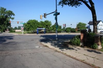
View of the historic marker situated in front of the Black Rock community park.
Burning of Blackrock and Buffalo Marker image. Click for full size.
Photographed By Dale K. Benington, June 10, 2012
4. Burning of Blackrock and Buffalo Marker
View of the historic marker (seen just to the left of the tree) looking west along Amherst Street. The British originally landed just down the street, at the foot of Amherst Street.
 
 
Credits. This page was last revised on February 16, 2023. It was originally submitted on July 3, 2012, by Dale K. Benington of Toledo, Ohio. This page has been viewed 1,239 times since then and 51 times this year. Photos:   1, 2, 3, 4. submitted on July 3, 2012, by Dale K. Benington of Toledo, Ohio.
Share this page.  
Share on Tumblr
m=57098

CeraNet Cloud Computing sponsors the Historical Marker Database.
This website earns income from purchases you make after using our links to Amazon.com. We appreciate your support.
Paid Advertisement
Apr. 25, 2024