Marker Logo HMdb.org THE HISTORICAL
MARKER DATABASE
“Bite-Size Bits of Local, National, and Global History”
Attapulgus in Decatur County, Georgia — The American South (South Atlantic)
 

Attapulgus Presbyterian Cemetery


Attapulgus Presbyterian Cemetery Marker image. Click for full size.
Photographed By David Seibert, May 16, 2012
1. Attapulgus Presbyterian Cemetery Marker
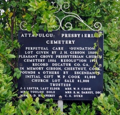
Inscription. Perpetual Care Foundation Lot given by J. H. Gibson 1850 Pleasant Grove Presbyterian Church Cemetery 1854 Resolution 1966 Record Decatur Co, GA. In Memory Gibson, Chestnut, Cook, Pound & others by descendants. Initial gift W.P. Cook $1,000 Church lot sale $1,000 Trustees J.J. Lester, Last Elder Mrs. W.P. Cook Mrs. Toulou Dole Mrs. R. M. Darsey, Dec. Mrs. R. D. Humphrey C. E. Duke
 
Topics. This historical marker is listed in this topic list: Cemeteries & Burial Sites. A significant historical year for this entry is 1850.
 
Location. 30° 44.667′ N, 84° 29.033′ W. Marker is in Attapulgus, Georgia, in Decatur County. Marker is at the intersection of Main Street (Georgia Route 241) and Church Street, on the left when traveling south on Main Street. Touch for map. Marker is in this post office area: Attapulgus GA 39815, United States of America. Touch for directions.
 
Other nearby markers. At least 8 other markers are within 9 miles of this marker, measured as the crow flies. Attapulgus Cemetery Inc. (about 500 feet away, measured in a direct line); Attapulgus High School (approx. 0.2 miles away); Attapulgite / Fullers Earth (approx. 0.3 miles away); Attapulgus (approx. 0.3 miles away); Amsterdam, Georgia / Shade Grown Tobacco (approx. 3.3 miles away); Gragg Lumber Company (approx. 3.3 miles away); The Village, the Pits, and the Dumps
Paid Advertisement
Click on the ad for more information.
Please report objectionable advertising to the Editor.
Click or scan to see
this page online
(approx. 3.3 miles away); Charles James Munnerlyn / “Refuge” (approx. 8.3 miles away). Touch for a list and map of all markers in Attapulgus.
 
Attapulgus Presbyterian Cemetery Marker image. Click for full size.
Photographed By David Seibert, May 16, 2012
2. Attapulgus Presbyterian Cemetery Marker
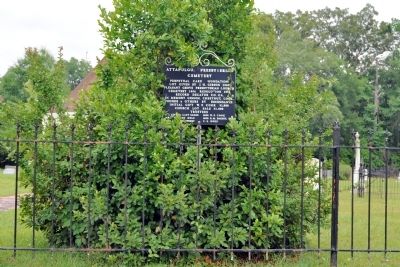
Attapulgus Presbyterian Cemetery Marker image. Click for full size.
Photographed By David Seibert, May 16, 2012
3. Attapulgus Presbyterian Cemetery Marker
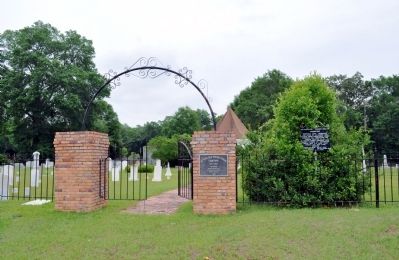
The marker stands to the right of the entrance arch.
Attapulgus Presbyterian Cemetery image. Click for full size.
Photographed By David Seibert, May 16, 2012
4. Attapulgus Presbyterian Cemetery
Attapulgus Presbyterian Cemetery image. Click for full size.
Photographed By David Seibert, May 16, 2012
5. Attapulgus Presbyterian Cemetery
 
 
Credits. This page was last revised on June 6, 2020. It was originally submitted on July 10, 2012, by David Seibert of Sandy Springs, Georgia. This page has been viewed 576 times since then and 21 times this year. Photos:   1, 2, 3, 4, 5. submitted on July 10, 2012, by David Seibert of Sandy Springs, Georgia. • Craig Swain was the editor who published this page.
Share this page.  
Share on Tumblr
m=57360

CeraNet Cloud Computing sponsors the Historical Marker Database.
This website earns income from purchases you make after using our links to Amazon.com. We appreciate your support.
Paid Advertisement
Apr. 25, 2024