Guernsey in Platte County, Wyoming — The American West (Mountains)
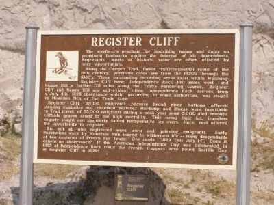
Register Cliff
Along the Oregon Trail, famed transcontinental route of the 19th century, pertinent dates are from the 1820's through the 1860's. Three outstanding recording areas exist within Wyoming: Register Cliff here; Independence Rock, 180 miles west; and Names Hill, a further 175 miles along the Trail's wandering course. Register Cliff and Names Hill are self-evident titles; Independence Rock derives from a July 4th 1825 observance which, according to some authorities, was staged by Mountain Men of Fur Trade fame.
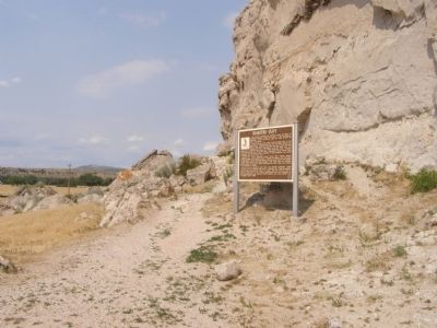
Register Cliff invited emigrants because broad river bottoms offered pleasing campsites and excellent pasture. Hardship and illness were inevitable to Trail travel; of 55,000 emigrants during a peak years, some 5,000 died enroute. Cliffside graves attest to the high mortality. This being their lot, travelers eagerly sought and singularly valued recuperative layovers. Here, rest offered the opportunity to register.
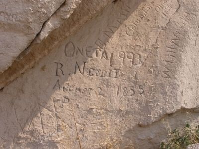
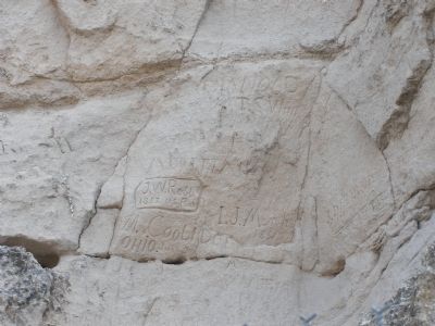
But not all who registered were worn and grieving emigrants. early inscriptions were by Mountain Men inured to wilderness life -- many descendants of two centuries of French Fur Trade; One reads: 1829 This July 14. Does it denote an observance? If the American Independence Day was celebrated in 1825 at Independence Rock could the French trappers have noted Bastille Day at Register Cliff in 1829?
Erected by State of Wyoming.
Topics and series. This historical marker is listed in these topic lists: Landmarks • Roads & Vehicles • Settlements & Settlers. In addition, it is included in the Oregon Trail series list. A significant historical month for this entry is July 1830.
Location. 42° 14.87′ N, 104° 42.677′ W. Marker is in Guernsey, Wyoming, in Platte County. Marker is in Register Cliff State Historic Site. Touch for map. Marker is in this post office area: Guernsey WY 82214, United States of America. Touch for directions.
Other nearby markers. At least 8 other markers are within 2 miles of this marker, measured as the crow flies. Register Cliff State Historic Site (here, next to this marker); Oregon Trail Memorial (a few steps from this marker); Centre Star Station (approx. 0.3 miles away); North Platte River (approx. 1.2 miles away); Lock and Roll Down a Rocky Road (approx. 1.2 miles away); Oregon Trail Ruts (approx. 2 miles away); The US Army’s Role in Protecting the Oregon Trail is Best Described by the Soldiers (approx. 2 miles away); Oregon Trail Ruts State Historic Site (approx. 2 miles away). Touch for a list and map of all markers in Guernsey.
More about this marker. Follow South Guernsey Road south out of Guernsey. After you cross the river (west to Trail Ruts), continue on South Guernsey Road for just over a mile. You'll see the sign for Register Cliff State Historic Site. It's at the end (about a mile) of this dirt road.
Credits. This page was last revised on June 16, 2016. It was originally submitted on February 25, 2008, by Christopher Light of Valparaiso, Indiana. This page has been viewed 3,969 times since then and 31 times this year. Photos: 1, 2, 3, 4. submitted on February 25, 2008, by Christopher Light of Valparaiso, Indiana. • Kevin W. was the editor who published this page.


