Bournedale in Barnstable County, Massachusetts — The American Northeast (New England)
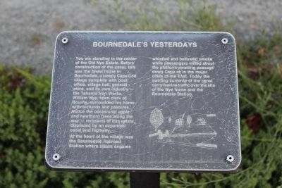
Bournedale's Yesterdays
At the heart of the village was the Bournedale Railroad Station where steam engines whistled and bellowed smoke while passengers milled about the platform awaiting passage down Cape or to the major cities of the East. Today the swirling currents of the canal carry marine traffic over the site of the Nye home and the Bournedale Station.
Erected by U.S. Army Corps of Engineers.
Topics. This historical marker is listed in these topic lists: Horticulture & Forestry • Railroads & Streetcars • Settlements & Settlers.
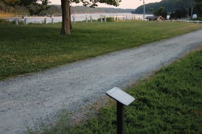
Location. Marker has been reported missing. It was located near 41° 46.328′ N, 70° 33.769′ W. Marker was in Bourne, Massachusetts, in Barnstable County. It was in Bournedale. Marker was on Scenic Highway (U.S. 6), on the right when traveling north. Marker is located in Herring Run Recreation Area. Touch for map. Marker was in this post office area: Buzzards Bay MA 02532, United States of America. Touch for directions.
Other nearby markers. At least 8 other markers are within 3 miles of this location, measured as the crow flies. Burying Hill (approx. 0.2 miles away); Still on Patrol (approx. ¼ mile away); Cape Cod Canal (approx. half a mile away); August Belmont (approx. half a mile away); William Barclay Parsons (approx. half a mile away); Monica Dickens Stratton (approx. half a mile away); a different marker also named The Cape Cod Canal (approx. 0.8 miles away); Edmund Freeman Saddle & Pillion Burial Ground (approx. 2.3 miles away).
Regarding Bournedale's Yesterdays. Visited 02/14/2023 & this marker along with a few others were missing.
Credits. This page was last revised on March 8, 2023. It was originally submitted on July 15, 2012, by Bryan Simmons of Attleboro, Massachusetts. This page has been viewed 795 times since then and 20 times this year. Last updated on March 3, 2023, by Greg Golfomitsos of East Sandwich, Massachusetts. Photos: 1, 2. submitted on July 15, 2012, by Bryan Simmons of Attleboro, Massachusetts. • Bill Pfingsten was the editor who published this page.

