Kingston in Ulster County, New York — The American Northeast (Mid-Atlantic)
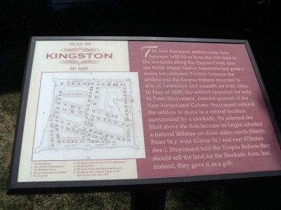
Plan of Kingston in 1695
The first European settlers came here between 1652-53 to farm the rich land in the lowlands along the Esopus Creek near the fields where Native Americans had grown maize for centuries. Friction between the settlers and the Esopus Indians mounted to acts of vandalism and assaults on both sides. In May of 1658, the settlers appealed for help to Peter Stuyvesant, director-general of the New Netherland Colony. Stuyvesant ordered the settlers to move to a central location surrounded by a stockade. He selected the bluff above the flats because its height afforded a natural defense on three sides: north (North Front St.): west (Green St.) and east (Clinton Ave.). Stuyvesant told the Esopus Indians they should sell the land for the Stockade Area, but, instead, they gave it as a gift.
Topics. This historical marker is listed in these topic lists: Colonial Era • Native Americans. A significant historical month for this entry is May 1658.
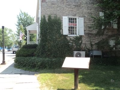
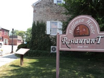
Location. 41° 56.096′ N, 74° 1.375′ W. Marker is in Kingston, New York, in Ulster County. Marker is on N Front Street near Green Street, on the left when traveling west. Marker is located just south of the Hoffman House. Touch for map. Marker is at or near this postal address: 94 N Front Street, Kingston NY 12401, United States of America. Touch for directions.
Other nearby markers. At least 8 other markers are within walking distance of this marker. Hoffman House (here, next to this marker); a different marker also named Plan of Kingston in 1695 (within shouting distance of this marker); Kingston Academy (about 700 feet away, measured in a direct line); The Four Corners (about 700 feet away); a different marker also named Kingston Academy (about 700 feet away); Medal of Honor (about 700 feet away); The Pike Plan (approx. 0.2 miles away); Burning of Kingston (approx. 0.2 miles away). Touch for a list and map of all markers in Kingston.
More about this marker. A map of the stockade area appears at the left side of the marker. Indicated on the map are the Blockhouse, the Church and burying place, the Ministers House, The part separated and fortified, the Stockade, the House where the Governor is entertained, the Town Gates, the Gates to the separated fortified yard, and the House where the first Senator of the State of New York sat in 1777.
Credits. This page was last revised on June 16, 2016. It was originally submitted on July 15, 2012, by Bill Coughlin of Woodland Park, New Jersey. This page has been viewed 535 times since then and 24 times this year. Photos: 1, 2. submitted on July 15, 2012, by Bill Coughlin of Woodland Park, New Jersey. 3, 4. submitted on July 16, 2012, by Bill Coughlin of Woodland Park, New Jersey.


