Neodesha in Wilson County, Kansas — The American Midwest (Upper Plains)
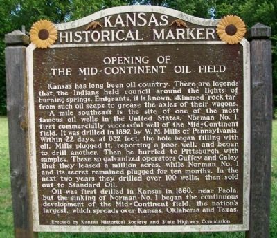
Opening of the Mid-Continent Oil Field
Kansas has long been oil country. There are legends that Indians held council around the lights of burning springs. Emigrants, it is known, skimmed "rock tar" from such oil seeps to grease the axles of their wagons.
A mile southeast is the site of one of the most famous oil wells in the United States, Norman No. 1, first commercially successful well of the Mid-Continent field. It was drilled in 1892 by W. M. Mills of Pennsylvania. Within 22 days, at 832 feet, the hole began filling with oil. Mills plugged it, reporting a poor well and began to drill another. Then he hurried to Pittsburgh with samples. These so galvanized operators Guffey and Galey that they leased a million acres, while Norman No. 1 and its secret remained plugged for ten months. In the next two years they drilled over 100 wells, then sold out to Standard Oil.
Oil was first drilled in Kansas in 1860, near Paola, but the sinking of Norman No. 1 began the continuous development of the Mid-Continent field, the nation's largest, which spreads over Kansas, Oklahoma, and Texas.
Erected by Kansas Historical Society and State Highway Commission. (Marker Number 57.)
Topics and series. This historical marker is listed in these topic lists: Industry & Commerce • Native Americans • Settlements & Settlers. In addition, it is included in the Kansas Historical Society series list. A significant historical year for this entry is 1892.
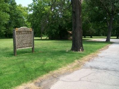
Location. 37° 25.093′ N, 95° 41.747′ W. Marker is in Neodesha, Kansas, in Wilson County. Marker is on Main Street (U.S. 75), on the left when traveling east. Marker is at a roadside pulloff. Touch for map. Marker is at or near this postal address: 2836 US Highway 75, Neodesha KS 66757, United States of America. Touch for directions.
Other nearby markers. At least 8 other markers are within 2 miles of this marker, measured as the crow flies. Dutch Lorbeer (within shouting distance of this marker); Brown Hotel (approx. 0.8 miles away); Soldiers of the World War (approx. 0.8 miles away); World War II Memorial (approx. 0.8 miles away); Sgt Mike Ritter (approx. 0.9 miles away); Norman No. 1 (approx. 1.2 miles away); Actual Site of Norman No. 1 (approx. 1.3 miles away); World War Homefront and Neodesha Cemetery Association Founders Memorial Pavilion (approx. 1˝ miles away). Touch for a list and map of all markers in Neodesha.
Also see . . .
1. Kansas Oil Boom. American Oil & Gas Historical Society website entry (Submitted on February 8, 2022, by Larry Gertner of New York, New York.)
2. Norman No. 1. Kansapedia website entry (Submitted on July 17, 2012, by William Fischer, Jr. of Scranton, Pennsylvania.)
Credits. This page was last revised on February 8, 2022. It was originally submitted on July 17, 2012, by William Fischer, Jr. of Scranton, Pennsylvania. This page has been viewed 427 times since then and 14 times this year. Photos: 1, 2. submitted on July 17, 2012, by William Fischer, Jr. of Scranton, Pennsylvania.

