Near Sharpsburg in Washington County, Maryland — The American Northeast (Mid-Atlantic)
Jackson's Command
Colquitt's Brigade, D.H. Hill's Division
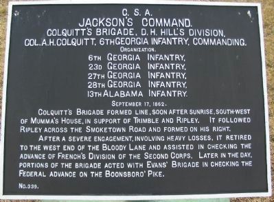
Jackson's Command.
Colquitt's Brigade, D.H. Hill's Division.
Col. A.H. Colquitt, 6th Georgia Infantry, Commanding.
Organization.
6th Georgia Infantry,
23d Georgia Infantry,
27th Georgia Infantry,
28th Georgia Infantry,
13th Alabama Infantry.
September 17, 1862.
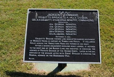
Colquitt's Brigade formed line, soon after sunrise, south-west of Mumma's House, in support of Trimble and Ripley. It followed Ripley across the Smoketown Road and formed on his right.
After a severe engagement, involving heavy losses, it retired to the west end of the Bloody Lane and assisted in checking the advance of French's Division of the Second Corps. Later in the day, portions of the Brigade acted with Evan's Brigade in checking the Federal Advance on the Boonsboro' Pike.
Erected by Antietam Battlefield Board. (Marker Number 339.)
Topics and series. This historical marker is listed in this topic list: War, US Civil. In addition, it is included in the Antietam Campaign War Department Markers series list. A significant historical month for this entry is September 1817.
Location. 39° 28.864′ N, 77° 44.63′ W. Marker is near Sharpsburg, Maryland, in Washington County. Marker is on Cornfield Avenue, on the right when traveling west. Located between stops three and four of the driving tour of Antietam Battlefield. Touch for map. Marker is in this post office area: Sharpsburg MD 21782, United States of America. Touch for directions.
Other nearby markers. At least 8 other markers are within walking distance of this marker. U.S. Artillery (a few steps from this marker); Battery B (a few steps from this marker); First New Jersey Brigade (a few steps from this marker); First Army Corps (within shouting distance of this marker); a different marker also named Jackson's Command (within shouting distance of this marker); a different marker also named First Army Corps (within shouting distance of this marker); Ricketts' Division, First Army Corps (within shouting distance of this marker); Longstreet's Command (within shouting distance of this marker). Touch for a list and map of all markers in Sharpsburg.
Also see . . .
1. Antietam Batlefield. National Park Service site. (Submitted on February 26, 2008, by Craig Swain of Leesburg, Virginia.)
2. Colquitt's Brigade. The Brigade saw action here at the Cornfield and later on the left end of the Sunken Road. As noted on the marker some elements assisted Evans' Brigade in yet a third sector of the battlefield, near the Boonsboro Pike. (Submitted on February 26, 2008, by Craig Swain of Leesburg, Virginia.)
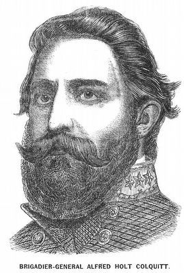
3. Alfred H. Colquitt. Alfred Holt Colquitt (April 20, 1824 – March 26, 1894) was a lawyer, preacher, soldier, 49th Governor of Georgia (1877-1882) and two-term U.S. Senator from Georgia (1883-1894), dying in office. He served as an officer in the Confederate army, reaching the rank of major general. (Submitted on October 22, 2015, by Brian Scott of Anderson, South Carolina.)
Photographed By Craig Swain
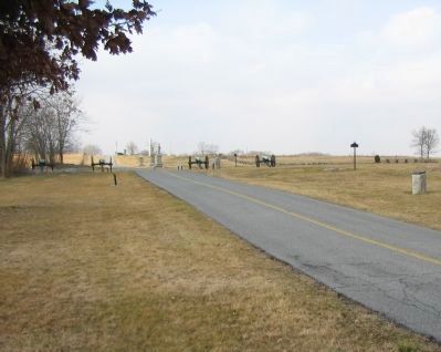
3. Four Cannon, Two Tablets, and the 1st New Jersey Brigade Monument
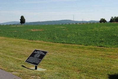
Along this section of Cornfield Avenue, to the east of the four gun artillery display, are War Department Tablets 339 (left side of road) and 83 (right side of road). To the far right is the 1st New Jersey Brigade monument.
Photographed By Craig Swain, February 9, 2008
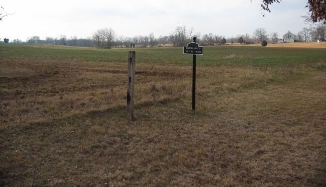
6. Colquitt's Brigade Advance and Later Retreat
Looking from the marker location back toward the Hagerstown Pike. The sign indicates the western edge of the East Woods. Initially posted on the Sunken Road, the Brigade moved up by way of the Mumma's Farm Lane to the edge of the East Woods. Advancing from a point on the Smoketown Road, the Brigade then attacked through the foreground here and drove sections of Ricketts' Division back into the East Woods, out of the cornfield. With the advance of XII Corps from the east, Colquitt's Brigade fell back through the low ground in the distance toward the Dunker Church.
Credits. This page was last revised on October 23, 2017. It was originally submitted on February 26, 2008, by Craig Swain of Leesburg, Virginia. This page has been viewed 927 times since then and 19 times this year. Photos: 1. submitted on February 26, 2008, by Craig Swain of Leesburg, Virginia. 2. submitted on October 22, 2015, by Brian Scott of Anderson, South Carolina. 3. submitted on February 26, 2008, by Craig Swain of Leesburg, Virginia. 4, 5. submitted on October 22, 2015, by Brian Scott of Anderson, South Carolina. 6. submitted on February 26, 2008, by Craig Swain of Leesburg, Virginia.
