Trenton in Dade County, Georgia — The American South (South Atlantic)
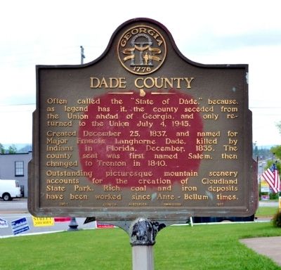
Dade County
Created December 25, 1837, and named for Major Francis Langhorne Dade, killed by Indians in Florida, December, 1835. The county seat was first named Salem, then changed to Trenton in 1840.
Outstanding picturesque mountain scenery accounts for the creation of Cloudland State Park. Rich coal and iron deposits have been worked since Ante-Bellum times.
Erected 1953 by Georgia Historical Commission. (Marker Number 041-1.)
Topics and series. This historical marker is listed in this topic list: Political Subdivisions. In addition, it is included in the Georgia Historical Society series list. A significant historical date for this entry is July 4, 1935.
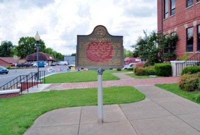
Location. 34° 52.333′ N, 85° 30.547′ W. Marker is in Trenton, Georgia, in Dade County. Marker is at the intersection of Main Street (U.S. 11) and Court StreetAnoth, in the median on Main Street. Touch for map. Marker is in this post office area: Trenton GA 30752, United States of America. Touch for directions.
Other nearby markers. At least 8 other markers are within 5 miles of this marker, measured as the crow flies. Trenton (within shouting distance of this marker); Union School (approx. 0.6 miles away); Macon Iron Works (approx. 0.9 miles away); Payne's (Sitton's) Mill (approx. 1.1 miles away); The O'Neal House (approx. 1.2 miles away); White Oak Gap (approx. 1.8 miles away); Stories in Stone (approx. 3 miles away); Cole Plantation and Academy (approx. 4.2 miles away). Touch for a list and map of all markers in Trenton.
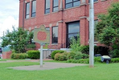
More about this marker. The marker stands in front of the Dade County Courthouse.
Regarding Dade County. Another reason for the "State of Dade" nickname: until 1939, there were no roads connecting Dade County with rest of Georgia. The county could only be accessed from Alabama or Tennessee.
The county's official web site is at http://www.dadecounty-ga.gov/
Credits. This page was last revised on August 25, 2019. It was originally submitted on July 22, 2012, by David Seibert of Sandy Springs, Georgia. This page has been viewed 807 times since then and 26 times this year. Photos: 1, 2, 3, 4, 5. submitted on July 22, 2012, by David Seibert of Sandy Springs, Georgia. • Craig Swain was the editor who published this page.
