Near Anderson in Shasta County, California — The American West (Pacific Coastal)
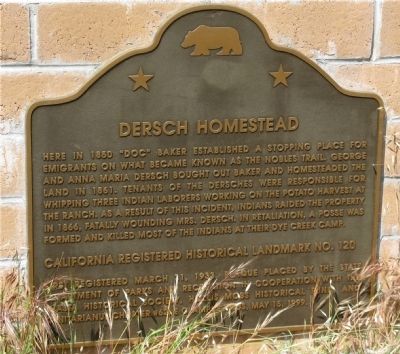
Dersch Homestead
California Registered Landmark No.120
Erected by First Registered March 31, 1933. Plaque placed by the State Department of Parks and Recreation in cooperation with the Shasta Historical Society, the Hollis Moss Historical Fund and Trinitarianus Chapter #62 E Clampus Vitus May 15, 1999. (Marker Number 120.)
Topics and series. This historical marker is listed in these topic lists: Landmarks • Settlements & Settlers. In addition, it is included in the California Historical Landmarks, and the E Clampus Vitus series lists. A significant historical year for this entry is 1850.
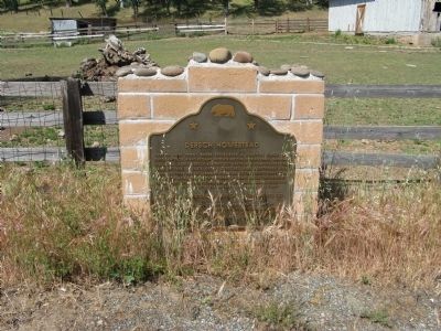
Location. 40° 29.173′ N, 122° 9.052′ W. Marker is near Anderson, California, in Shasta County. Marker is on Dersch Road, on the left when traveling east . Touch for map. Marker is in this post office area: Anderson CA 96007, United States of America. Touch for directions.
Other nearby markers. At least 8 other markers are within 9 miles of this marker, measured as the crow flies. Nobles Trail - Bear Creek (about 300 feet away, measured in a direct line); Fort Reading. (approx. 4.2 miles away); Nobles Trail - Foot of the Mountain Station (approx. 4.6 miles away); Balls Ferry (approx. 5.2 miles away); Site of Reading Adobe (approx. 7.1 miles away); Historic County Jail (approx. 8.1 miles away); Masonic Lodge (approx. 8.2 miles away); Anderson Historic Fire Station (approx. 8.2 miles away). Touch for a list and map of all markers in Anderson.

Photographed By Brian Smith
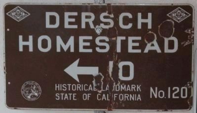
3. Dersch Homestead Road Directional Sign
This sign is part of the personal road sign collection of Brian Smith. He also contributed the following information:
Erected by the California State Automobile Association in 1937 and was the first generation sign used for Historical Landmarks. It contained two auto club logos and the state seal.
Click for more information.
Erected by the California State Automobile Association in 1937 and was the first generation sign used for Historical Landmarks. It contained two auto club logos and the state seal.
Click for more information.
Credits. This page was last revised on November 25, 2020. It was originally submitted on August 15, 2008, by Syd Whittle of Mesa, Arizona. This page has been viewed 1,996 times since then and 56 times this year. Last updated on July 25, 2012, by Michael Kindig of Elk Grove, California. Photos: 1, 2. submitted on August 15, 2008, by Syd Whittle of Mesa, Arizona. 3. submitted on June 8, 2009, by Syd Whittle of Mesa, Arizona.

